I have some JavaScript that queries for a parcel in a feature layer, successfully, and then zooms to the parcel using view.goTo(). It works great, except it zooms a little TOO close into the parcel. I'd like to have it fully display the parcel on the map, not go too far in. Any ideas?
Using ESRI's JavaScript 4.4 API
view<SPAN class="punctuation token">.</SPAN><SPAN class="token function">then</SPAN><SPAN class="punctuation token">(</SPAN><SPAN class="keyword token">function</SPAN><SPAN class="punctuation token">(</SPAN><SPAN class="punctuation token">)</SPAN> <SPAN class="punctuation token">{</SPAN>
<SPAN class="keyword token">var</SPAN> url <SPAN class="operator token">=</SPAN> urlUtils<SPAN class="punctuation token">.</SPAN><SPAN class="token function">urlToObject</SPAN><SPAN class="punctuation token">(</SPAN>document<SPAN class="punctuation token">.</SPAN>URL<SPAN class="punctuation token">)</SPAN><SPAN class="punctuation token">;</SPAN>
<SPAN class="comment token">//make sure we have parameters</SPAN>
<SPAN class="keyword token">if</SPAN> <SPAN class="punctuation token">(</SPAN>url<SPAN class="punctuation token">.</SPAN>query<SPAN class="punctuation token">)</SPAN> <SPAN class="punctuation token">{</SPAN>
<SPAN class="keyword token">var</SPAN> parcelNumber <SPAN class="operator token">=</SPAN> url<SPAN class="punctuation token">.</SPAN>query<SPAN class="punctuation token">.</SPAN>PID<SPAN class="punctuation token">;</SPAN>
<SPAN class="keyword token">return</SPAN> parcelLayer<SPAN class="punctuation token">.</SPAN><SPAN class="token function">then</SPAN><SPAN class="punctuation token">(</SPAN><SPAN class="keyword token">function</SPAN><SPAN class="punctuation token">(</SPAN><SPAN class="punctuation token">)</SPAN> <SPAN class="punctuation token">{</SPAN>
<SPAN class="keyword token">var</SPAN> query <SPAN class="operator token">=</SPAN> parcelLayer<SPAN class="punctuation token">.</SPAN><SPAN class="token function">createQuery</SPAN><SPAN class="punctuation token">(</SPAN><SPAN class="punctuation token">)</SPAN><SPAN class="punctuation token">;</SPAN>
query<SPAN class="punctuation token">.</SPAN>where <SPAN class="operator token">=</SPAN> <SPAN class="string token">"PID_NUM = '"</SPAN> <SPAN class="operator token">+</SPAN> parcelNumber <SPAN class="operator token">+</SPAN> <SPAN class="string token">"'"</SPAN><SPAN class="punctuation token">;</SPAN>
query<SPAN class="punctuation token">.</SPAN>outSpatialReference <SPAN class="operator token">=</SPAN> view<SPAN class="punctuation token">.</SPAN>spatialReference<SPAN class="punctuation token">;</SPAN>
<SPAN class="keyword token">return</SPAN> parcelLayer<SPAN class="punctuation token">.</SPAN><SPAN class="token function">queryFeatures</SPAN><SPAN class="punctuation token">(</SPAN>query<SPAN class="punctuation token">)</SPAN><SPAN class="punctuation token">;</SPAN>
<SPAN class="punctuation token">}</SPAN><SPAN class="punctuation token">)</SPAN><SPAN class="punctuation token">;</SPAN>
<SPAN class="punctuation token">}</SPAN>
<SPAN class="punctuation token">}</SPAN><SPAN class="punctuation token">)</SPAN>
<SPAN class="punctuation token">.</SPAN><SPAN class="token function">then</SPAN><SPAN class="punctuation token">(</SPAN>zoomTo<SPAN class="punctuation token">)</SPAN>
<SPAN class="punctuation token">.</SPAN><SPAN class="token function">then</SPAN><SPAN class="punctuation token">(</SPAN>highlight<SPAN class="punctuation token">)</SPAN><SPAN class="punctuation token">;</SPAN>
<SPAN class="keyword token">function</SPAN> <SPAN class="token function">zoomTo</SPAN><SPAN class="punctuation token">(</SPAN>response<SPAN class="punctuation token">)</SPAN> <SPAN class="punctuation token">{</SPAN>
<SPAN class="keyword token">var</SPAN> parcel <SPAN class="operator token">=</SPAN> response<SPAN class="punctuation token">.</SPAN>features<SPAN class="punctuation token">[</SPAN><SPAN class="number token">0</SPAN><SPAN class="punctuation token">]</SPAN><SPAN class="punctuation token">;</SPAN>
<SPAN class="comment token">//var parcelExtent = response.features[0].geometry.getExtent().expand(0.5);</SPAN>
view<SPAN class="punctuation token">.</SPAN><SPAN class="token function">goTo</SPAN><SPAN class="punctuation token">(</SPAN>parcel<SPAN class="punctuation token">)</SPAN><SPAN class="punctuation token">;</SPAN>
<SPAN class="comment token">//map.setExtent(parcelExtent);</SPAN>
<SPAN class="keyword token">return</SPAN> <SPAN class="punctuation token">(</SPAN>parcel<SPAN class="punctuation token">)</SPAN><SPAN class="punctuation token">;</SPAN>
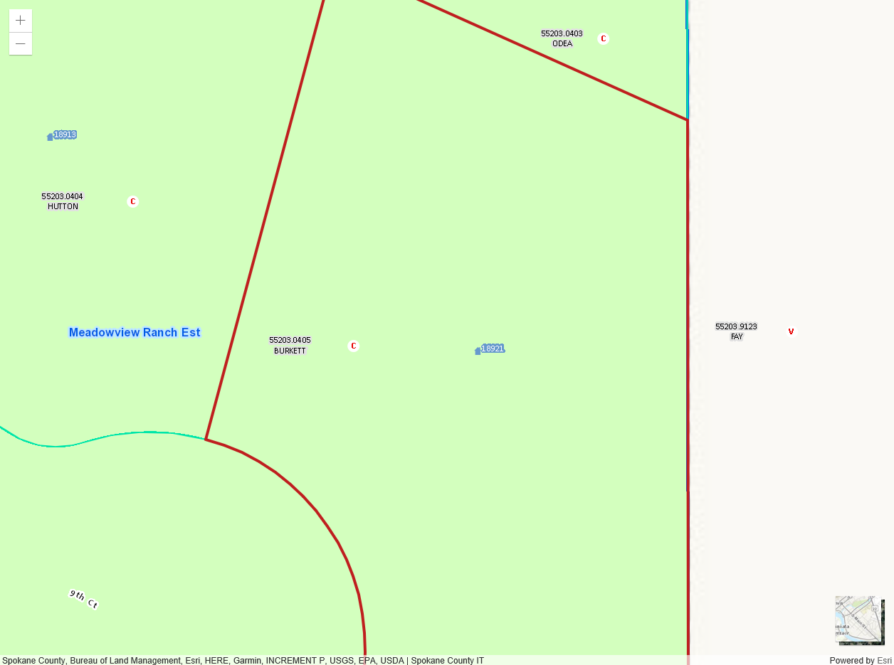
<SPAN class="punctuation token">}</SPAN><SPAN class="line-numbers-rows"><SPAN></SPAN><SPAN></SPAN><SPAN></SPAN><SPAN></SPAN><SPAN></SPAN><SPAN></SPAN><SPAN></SPAN><SPAN></SPAN><SPAN></SPAN><SPAN></SPAN><SPAN></SPAN><SPAN></SPAN><SPAN></SPAN><SPAN></SPAN><SPAN></SPAN><SPAN></SPAN><SPAN></SPAN><SPAN></SPAN><SPAN></SPAN><SPAN></SPAN><SPAN></SPAN><SPAN></SPAN><SPAN></SPAN></SPAN>Here is my zoomed map with the code above -- as you can see, it's not showing the full extent of the polygon I need to have zoomed into:
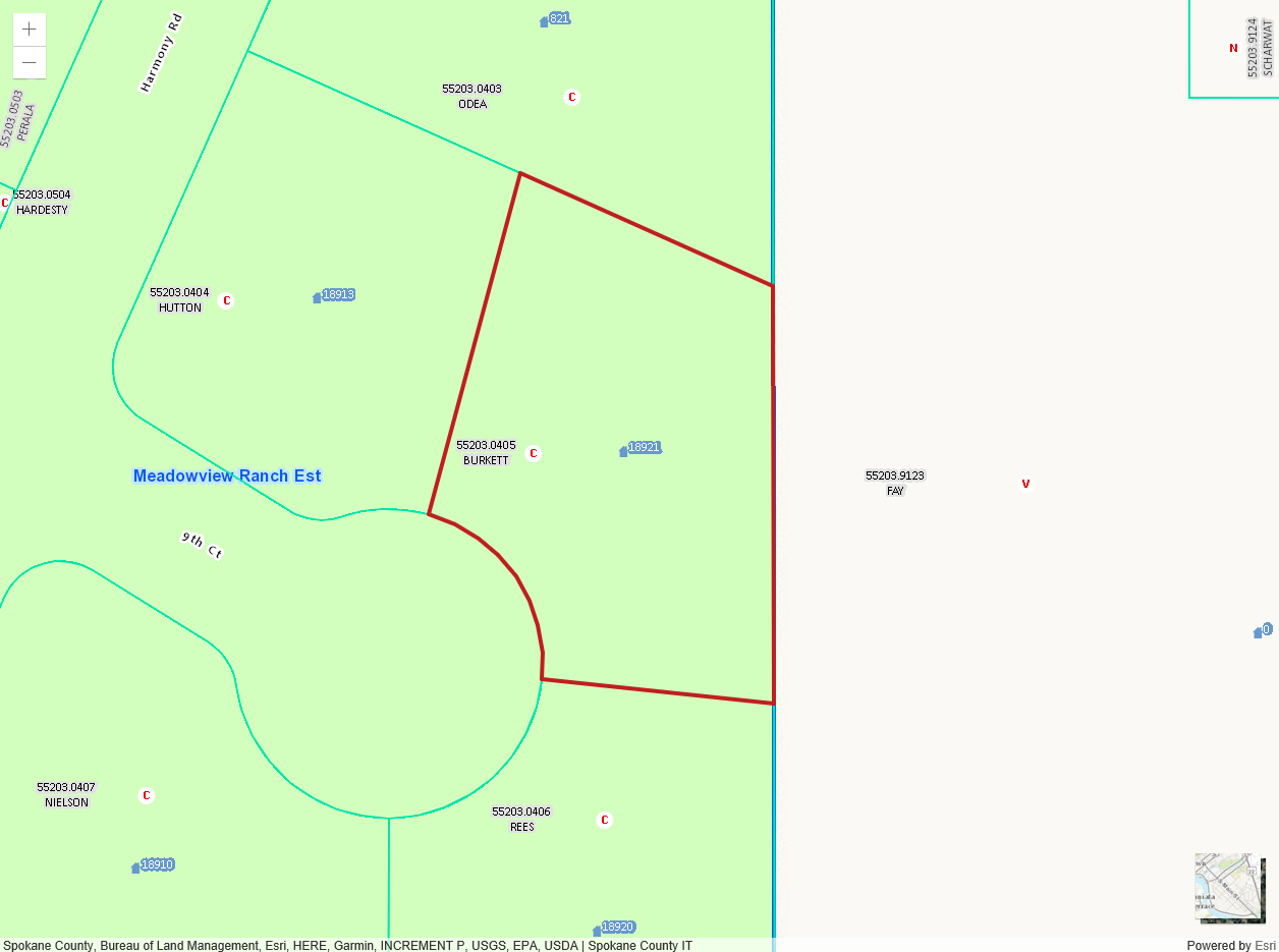
Here is a more preferable view one click zoomed out (though I'd rather have the polygon fill the space, but be completely visible in the map):
Thanks for any ideas.



