<\/HEAD>
Por segunda vez este mes, el Equipo de Contenido de ArcGIS ha mejorado los Community Basemaps<\/A> incorporando contenido nuevo y actualizado al ArcGIS Living Atlas of the World<\/A>. Gracias a la comunidad de usuarios, el World Topographic Map<\/A> fue renovado con 7 nuevos colaboradores y 8 actualizaciones para ciudades, condados y universidades en todo Estados Unidos.<\/P>Gracias a nuestra creciente comunidad de usuarios, nuestros basemaps se están actualizando con mayor frecuencia y con mejor contenido, haciendo estos mapas más precisos y útiles para todos.<\/P>
Daremos la bienvenida primero a nuestros colaboradores más recientes.<\/P>
Londonderry, NH 1:9K<\/STRONG><\/P>
 <\/A><\/P>Londonderry, NH<\/A> (Topo 1:9k a 1:1k) no pierde tiempo. Están ocupados incorporando su contenido en excelentes aplicaciones web como esta que describe las actividades recreativas al aire libre del área.<\/P>
 <\/A><\/P>
También en el noreste está
Reading, MA<\/A> (Topo 1:9k a 1:1k).<\/P>Reading, MA 1:9K<\/STRONG><\/P>
 <\/A><\/P>
Reading también está reconociendo los beneficios que trae la
participación en Community Maps<\ / A > creando varios mapas web y aplicaciones útiles como este mapa de humedales.<\ / P >< P style = " margin : 0 0 10 px ; font - family : Arial , Helvetica , sans - serif ; color : #333333 ; font - size : 14 px ; ">< A href = " http : //readingma.maps.arcgis.com/apps/OnePane/basicviewer/index.html?appid=a77e359bb54f4640a15a116b62609a02 " style = " color : #007ac2 ; " target = " _blank " rel = " nofollow noopener noreferrer ">< IMG alt = " " class = " alignnone wp-image-42189 jive-image size-full " height = "441 " src = " http : //blogs.esri.com/esri/arcgis/files/2014/09/Reading-MA_WebApp2.jpg " style = " background-color : #f5f5f5 ; border : none ; margin : 0 20 px 10 px 0 ; padding : 10 px ; "/ >< / A >< / P >< P style = " margin : 0 0 10 px ; font - family : Arial , Helvetica , sans - serif ; color : #333333 ; font - size : 14 px ; "> Bajando hacia el sureste encontramos < A href = " http : //www.arcgis.com/home/webmap/viewer.html?webmap=6e03e8c26aad4b9c92a87c1063ddb0e3¢er=%20%20-80.581416,35.416387&level=16 " style = " color :#007ac2 ; " target = " _blank " title = " Cabarrus County , NC " rel = " nofollow noopener noreferrer "> Cabarrus County , NC < / A > (Topo de1 :9k a1 :1k ). < / P >< P style = " margin :1010 px ;font-family :Arial ,Helvetica ,sans-serif ;color :#333333 ;font-size :14 px ; ">< STRONG > Cabarrus County , NC1 :9K < / STRONG >< / P >< P style = " margin :1010 px ;font-family :Arial ,Helvetica ,sans-serif ;color :#333333 ;font-size :14 px ; ">< A href = " http : //www.arcgis.com/home/webmap/viewer.html?webmap=6e03e8c26aad4b9c92a87c1063ddb0e3¢er=%20%20-80.581416,35.416387&level=16 " style = " color :#007ac2 ; " target = " _blank " rel = " nofollow noopener noreferrer ">< IMG alt = " " class = " alignnone jive-image wp-image-42096 " height = "717 " src = " http : //blogs.esri.com/esri/arcgis/files/2014/09/CabarrusCountyNC1.jpg " style = " background-color :#f5f5f5 ; border :none ; margin :2020101010 px ; padding :10 px ; width :866 px ; height :717.0587023686921 px ; "/ >< / A >< / P >< P style = " margin :10101010 px ;10101010 font-family :Arial ,Helvetica ,sans-serif ;10101010 color :#333333 ;10101010 font-size :14 px ; "> Cabarrus County está produciendo todo tipo de mapas web y aplicaciones que incluyen mapas de zonificación, lugares de votación, distritos congresionales y mucho más. Aquí hay un gran ejemplo que incorpora muchos temas comunitarios importantes en un solo mapa web.< / P >< P style = " margin :10101010 px ;10101010 font-family :Arial ,Helvetica ,sans-serif ;10101010 color :#333333 ;10101010 font-size :14 px ; ">< A href = " http://gis.cabarruscounty.us/mycabarrusgis/default.htm " style = " color:#007ac2 ; "> < IMG alt = '' class='alignnone wp-image-42098 jive-image' height='452' src='http://blogs.esri.com/esri/arcgis/files/2014/09/CabarrusCountyNCWebApp11.jpg' style='background-color:#f5f5f5;border:none;margin-right:20 px;margin-bottom:10 px;padding:10 px;width:874 px;height:452.4663428174879 px;' width='874' /> </ A > < / P >< P style='margin:0010ピクセル;フォントファミリー:Arial、Helvetica、サンセリフ;カラー:#333333;フォントサイズ:14ピクセル;'> < A href='http://www.arcgis.com/home/webmap/viewer.html?webmap=6e03e8c26aad4b9c92a87c1063ddb0e3¢er=%20%20-84.801241,33.374918&level=16'スタイル='カラー:#007ac2;'ターゲット='_ブランク'タイトル='Coweta County,GA'rel='nofollow noopener noreferrer'>Coweta County,GA</ A>(Topo1:9kから1:1k)も私たちのコミュニティに参加しました。< / p >< pスタイル='マージン:00010ピクセル;フォントファミリー:Arial、Helvetica、サンセリフ;カラー:#333333;フォントサイズ:14ピクセル;'> < strong>Coweta County,GA(Newnan,GA郡庁所在地)1:9K</ strong> < / p >< pスタイル='マージン:00010ピクセル;フォントファミリー:Arial、Helvetica、サンセリフ;カラー:#333333;フォントサイズ:14ピクセル;'> < a href='http://www.arcgis.com/home/webmap/viewer.html?webmap=6e03e8c26aad4b9c92a87c1063ddb0e3¢er=%20%20-84.801241,33.374918&level=16'スタイル='カラー:#007ac2;'ターゲット='_ブランク'rel='nofollow noopener noreferrer'> < img alt=''クラス='alignnone wp-image-42100 jive-image'高さ='687' src='http://blogs.esri.com/esri/arcgis/files/2014/09/CowetaGA_Newnan.jpg'スタイル='背景色:#f5f5f5;border:none;margin-right:20ピクセル;margin-bottom:10ピクセル;padding:10ピクセル;width:872ピクセル;height:686.8652988403211ピクセル;'幅='872'/> </ a> < / p >< pスタイル='マージン:00010ピクセル;フォントファミリー:Arial、Helvetica、サンセリフ;カラー:#333333;フォントサイズ:14ピクセル;'>この地域のための役立つ地図やアプリを見るのを楽しみにしています。< / p >< pスタイル='マージン:00010ピクセル;フォントファミリー:Arial、Helvetica、サンセリフ;カラー:#333333;フォントサイズ:14ピクセル;'>南東部の新しい貢献者を締めくくるのはPinellas County,FL</ A>(Topo1 :9kから1 :1k)。 style="color: #007ac2;" target="_blank" rel="nofollow noopener noreferrer">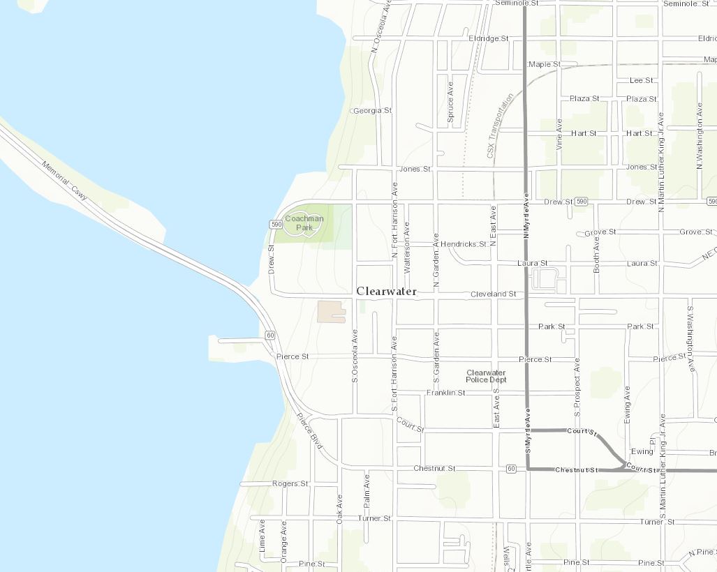 <\/A><\/P>
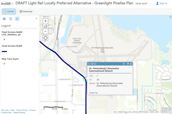
El Plan Greenlight Pinellas se ilustra a través de este mapa web, ofreciendo una mirada interactiva a las alternativas ferroviarias.<\/P>
 <\/A><\/P>
Dirigiéndose hacia el oeste a Arizona está
Glendale, AZ (Topo 1:9k a 1:1k), hogar del Super Bowl NFL 2015.<\/P>
Glendale, AZ 1:9K<\/STRONG><\/P>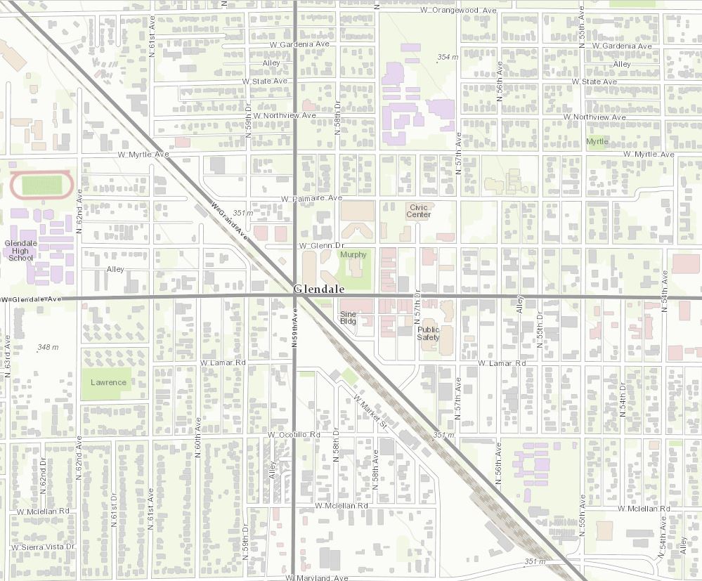 <\/A><\/P>
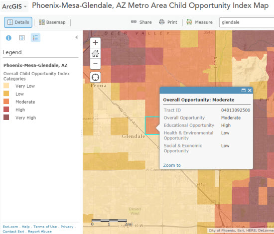
Glendale está creando una variedad de mapas web interesantes como este que ilustra el índice de oportunidad infantil. El Índice de Oportunidad Infantil se calcula en base a indicadores de Educación, Salud & Entorno Construido y Oportunidad Social & Económica del Vecindario.<\/P>
 <\/A><\/P>
Nuestro último nuevo colaborador es
Santa Clara County, CA (Topo 1:9k a 1:1k).<\/P>Santa Clara County, CA (San Jose, CA sede del condado) 1:9K<\/STRONG><\/P>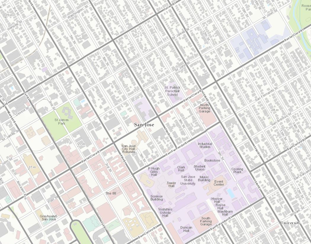 <\/A><\/P>
Santa Clara County ha creado con éxito este mapa web que describe datos de suelos. Este Servicio GIS puede ser usado en software GIS y está optimizado para el software ArcMap de Esri. ¡Un gran ejemplo de Web GIS!<\/P>
 <\/A><\/P>
Además de las grandes nuevas contribuciones, también hay nueve actualizaciones. Comenzando en el noreste están
Amherst and UMass Amherst, MA (Topo de1 :9k a1 :1k) y Cambridge, MA y Harvard University (Topo de1 :9k a1 :1k).<\/P>Amherst and UMass Amherst, MA1 :9K<\/STRONG><\/P>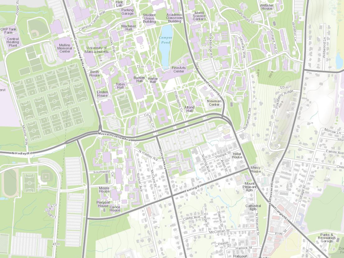 <\/A >< \/ P > < P style = " margin :
font-family :
Arial ,
Helvetica ,
sans-serif ; color :
#333 ; font-size :
14 px ; " > < STRONG > Cambridge , MA y Harvard University1 :9K < \/ STRONG > < \/ P > < P style = " margin :
font-family :
Arial ,
Helvetica ,
sans-serif ; color :
#333 ; font-size :
14 px ; " > < A href = " http  / www . arcgis . com / home / webmap / viewer . html ? webmap =6 e03 e8 c26 aad4 b9 c92 a87 c1063 ddb0 e3 & center = %20 %20 -71 .112206 ,42 .371793 & level =16 " style = " color :#007 ac2 " target = " _ blank " rel = " nofollow noopener noreferrer " > < IMG alt = " " class = " alignnone wp-image-42061 jive-image " height = "708 " src = " http / blogs . esri . com / esri / arcgis / files /2014 /09 / Cambridge -MA -and -Harvard -University . jpg " style = " background-color
  f5 f5 f5 ; border : none ; margin :
padding :
width :
870 px ; height :
707 .745995423341 px ; " width = "870 " /> < \/ A > < \/ P > < P style = " margin :
font-family :
Arial ,
Helvetica ,
sans-serif ; color :
#333 ; font-size :
14 px ; " > Bajando hacia el Atlántico medio , tenemos a < A href = " http / www . arcgis . com / home / webmap / viewer . html ? webmap =6 e03 e8 c26 aad4 b9 c92 a87 c1063 ddb0 e3 & center = %20 %20 -76 .610375 ,39 .290424 & level =16 " style = " color :#007 ac2 " target = " _ blank " title = " Baltimore , MD " rel = " nofollow noopener noreferrer " > Baltimore , MD </ A > ( Topo de1 :9 k a1 :1 k ) y < A href = " http / www . arcgis . com / home / webmap / viewer . html ? webmap =6 e03 e8 c26 aad4 b9 c92 a87 c1063 ddb0 e3 & center = %20 %20 -77 .432846 ,37 .540677 & level =16 " style = " color :#007 ac2 " target = " _ blank " title = " Henrico County , VA " rel = " nofollow noopener noreferrer " > Henrico County , VA </ A > ( Topo de1 :9 k a1 :1 k ) . < \/ P > < P style = " margin :
font-family :
Arial ,
Helvetica ,
sans-serif ; color :
#333 ; font-size :
14 px ; " > < STRONG > Baltimore , MD1 :9 K < \/ STRONG > < \/ P > < P style = " margin :
font-family :
Arial ,
Helvetica ,
sans-serif ; color :
#333 ; font-size :
14 px ; " > < A href = " http / www . arcgis . com / home / webmap / viewer . html ? webmap =6 e03 e8 c26 aad4 b9 c92 a87 c1063 ddb0 e3 & center = %20 %20 -76 .610375 ,39 .290424 & level =16 " style = " color :#007 ac2 " target = " _ blank " rel = " nofollow noopener noreferrer " > < IMG alt = " " class = " alignnone jive-image wp-image-42062 " height = "717 src=http://blogs.esri.com/esri/arcgis/files/2014/09/Baltimore-MD.jpg style=background-color:#f5f5f5;border:none;margin:
padding:
w idth:
auto;height:auto;width=875 /> </ A ></ P >< P style= style="background-color: #f5f5f5; border: none; margin: 0px 20px 10px 0px; padding: 10px; width: 871px; height: 730.1422722620266px;" width="871" "/><\/A><\/P>Más al sur, hacia el Sunshine State está
Bay County, FL (Topo 1:9k a 1:1k).<\/P>Bay County, FL (sede del condado de Panama City, FL) 1:9K<\/P>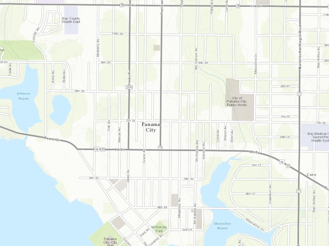 <\/A><\/P>
Dirigiéndonos hacia el oeste al centro de la nación está
Lee’s Summit, MO (Topo 1:9k a 1:1k).<\/P>Lee’s Summit, MO 1:9K<\/P>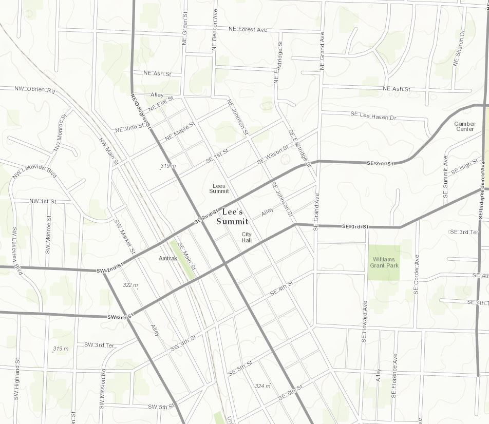 <\/A><\/P>
Nuestra próxima actualización está en el suroeste,
Clovis y Curry County, NM (Topo 1:9k a 1:1k).<\/P>Clovis y Curry County, NM 1:9K<\/P>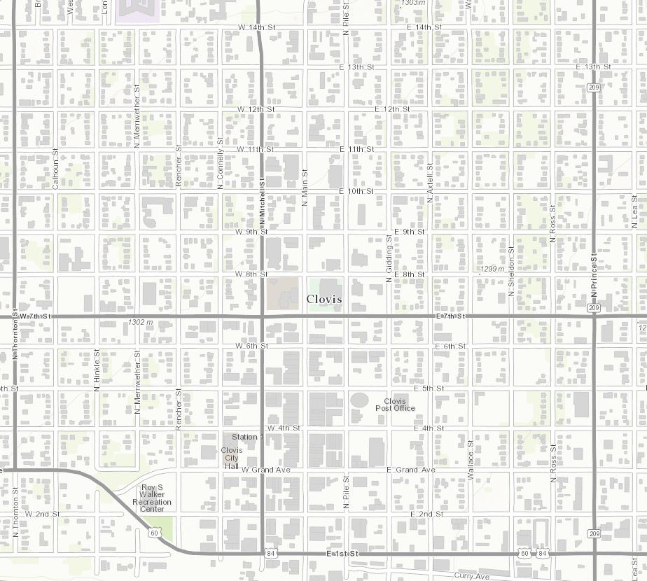 <\/A><\/P>
Finalmente, nuestra última actualización se encuentra en la costa oeste en
Woodland, CA (Topo 1 a 9k a 1 a 1k).<\/P>Woodland , CA 1 : 9K<\/STRONG ><\/ P >< P style = " margin : 0 a 10p x ; font - family : Arial , Helvetica , sans - serif ; color : #333333 ; font - size : 14p x ;">< A href = " http : // www . arcgis . com / home / webmap / viewer . html ? webmap =6 e03 e8 c26 aad4 b9 c92 a87 c1063 ddb0 e3 & amp ; center = %20 %20 -121 .772515 ,38 .677140 & amp ; level =16 " style = " color :#007 ac2 ; " target = " _ blank " rel = " nofollow noopener noreferrer " >< IMG alt = " " class = " alignnone jive - image wp - image -42076 " height = "757 " src = " http : // blogs . esri . com / esri / arcgis / files /2014 /09 / Woodland - CA . jpg " style = " background - color f5 f5 f5 ; border : none ; margin : 0 px 20 px 10 px 0 px ; padding : 10 px ; width :870 px ; height :757 .120253164557 px ; " width = "870 " \/ >< \/ A >< \/ P >< P style = " margin : 0 a 10p x ; font - family : Arial , Helvetica , sans - serif ; color :#333333 ; font - size :14 p x ; ">¡Muestre su organización! Si trabaja para una organización que se beneficia de < A href = " http : // resources . arcgis . com / en / communities / community - maps /01 w600000004000000 . htm " style = " color :#007 ac2 ; " target = " _ blank " title = " Community Maps - How to Participate " rel = " nofollow noopener noreferrer " > Community Maps Participation < \/ A > < SPAN > y le gustaría compartir su trabajo con nuestra comunidad de usuarios en expansión , por favor contacte a Shane Matthews (< \/ SPAN > < A class = " jive - link - email - small " href = " mailto : smatthews@esri.com " rel = " nofollow noopener noreferrer " > smatthews@esri.com < \/ A > < SPAN > ) o Community Maps (< \/ SPAN > < A class = " jive - link - email -small " href = " mailto : communitymaps@esri.com " rel = " nofollow noopener noreferrer " > communitymaps@esri.com < \/ A > < SPAN > ) y cuéntenos su historia y tenga la oportunidad de aparecer en un < \/ SPAN > < A href = " http : // video . arcgis . com / watch /3793 / community - maps - webinar-_ dash_- august -2014 " style = " color :#007 ac2 ; " target = " _ blank " title = " Community Maps Webinar " rel = " nofollow noopener noreferrer " > Community Maps Webinar segment < \/ A > . < \/ P >< P style = ' margin :11 px;font-family:2014,2014,2014,2014,2014,2014,2014,2014,2014,2014,2014,2014,2014,2014,2014,2014,2014,2014,2014,2014,2014,2014,2014,2014,2014,2014,
11:
.m.
-
noon,
para
aotro
gratis
webinar
lleno
de
noticias
eemocionantes
sobre
elCommunity Maps Program.<\/P>Sintonice para mantenerse al día con lo que sucede con Esri Community Maps. ¡Únase a nosotros el día 25! Aquí le mostramos cómo conectarse al webinar o simplemente haga clic en aquí para agregarlo a su calendario:<\/P>Tema:<\/STRONG> Community Maps Webinar<\/P>Fecha y hora:<\/STRONG> Jueves, septiembre 25, 2014, 11: m (PDT)<\/P>Unirse al webinar<\/A><\/STRONG><\/P>El audio para la conferencia está disponible a través de los altavoces de su computadora y teléfono o teleconferencia. La siguiente es la información de conexión para la opción de teleconferencia:<\/P>
Número gratuito para llamar (EE.UU./Canadá):<\/STRONG>855-244-8681<\/P>Número de llamada con tarifa (EE.UU./Canadá):<\/STRONG>650-479-3207<\/P>
Números globales para llamar<\/A><\/STRONG><\/P>Restricciones para llamadas gratuitas<\/STRONG><\/A><\/P>Código de acceso:<\/STRONG>803 457 805<\/P>Los temas incluirán…<\/P>Deane Kensok, gerente de ArcGIS Content, presentará una visión general del nuevo Living Atlas of the World y describirá el papel importante que juega Community Maps en la construcción de este recurso único.<\/LI><\/UL>Brett Horr del Town of York, Maine, compartirá cómo la participación en el programa Community Maps beneficia a los municipios pequeños.<\/LI><\/UL>Últimas noticias del equipo de Community Maps y tiempo para preguntas.<\/LI><\/UL>Aquí hay una lista de todos los contribuyentes comunitarios para esta versión:<\/STRONG><\/SPAN><\/P>Londonderry, NH<\/A> (Topo 1:9k a 1:1k) Nuevo Contribuyente<\/STRONG><\/LI>Reading, MA<\/A> (Topo 1:9k a 1:1k) Nuevo Contribuyente<\/STRONG><\/LI>Cabarrus County, NC<\/A> (Topo 1:9k a 1:1k) Nuevo Contribuyente<\/STRONG><\/LI>Coweta County, GA<\/A> (Topo 1:9k a 1:1k) Nuevo Contribuyente<\/STRONG><\/LI>Pinellas County, FL<\/A> (Topo 1:9k a 1:1k) Nuevo Contribuyente<\/STRONG><\/LI>Glendale, AZ<\/A> (Topo 1:9k a 1:1k) Nuevo Contribuyente<\/STRONG><\/STRONG><\/LI>Santa Clara County, CA<\/A> (Topo 1:9k a 1:1k) Nuevo Contribuyente<\/STRONG><\/LI>Amherst y UMass Amherst, MA<\/A> (Topo 1:9k a 1:1k) Actualización<\/STRONG><\/LI>Cambridge, MA y Harvard University<\/A> (Topo 1:9k a 1:1k) Actualización<\/STRONG><\/LI>Baltimore, MD<\/A> (Topo 1:9k a 1:1k) Actualización<\/STRONG><\/LI>Henrico County, VA<\/A> (Topo 1:9k a 1:1k) Actualización<\/STRONG><\/LI>Bay County, FL<\/A> (Topo 1:9k a 1:1k) Actualización<\/STRONG><\/LI><A href="http:\/\/www.arcgis.com/home/webmap/viewer.html?webmap=6e03e8c26aad4b9c92a87c1063ddb0e3¢er=%20%20-94.375959,38.914044&level=16" style=

