Hi all.
I am running into issues publishing a spatially enabled dataframe as a feature layer through the arcgis python api. I execute the following:
gis <SPAN class="operator token">=</SPAN> GIS<SPAN class="punctuation token">(</SPAN><SPAN class="operator token"><</SPAN>my portal<SPAN class="operator token">></SPAN><SPAN class="punctuation token">,</SPAN> <SPAN class="operator token"><</SPAN>user<SPAN class="operator token">></SPAN><SPAN class="punctuation token">,</SPAN> <SPAN class="operator token"><</SPAN>pw<SPAN class="operator token">></SPAN><SPAN class="punctuation token">)</SPAN>
feature_layer <SPAN class="operator token">=</SPAN> df_sub1<SPAN class="punctuation token">.</SPAN>spatial<SPAN class="punctuation token">.</SPAN>to_featurelayer<SPAN class="punctuation token">(</SPAN><SPAN class="string token">"test_df_to_fl"</SPAN><SPAN class="punctuation token">,</SPAN> gis<SPAN class="punctuation token">,</SPAN> <SPAN class="string token">'test'</SPAN><SPAN class="punctuation token">)</SPAN><SPAN class="line-numbers-rows"><SPAN></SPAN><SPAN></SPAN></SPAN>
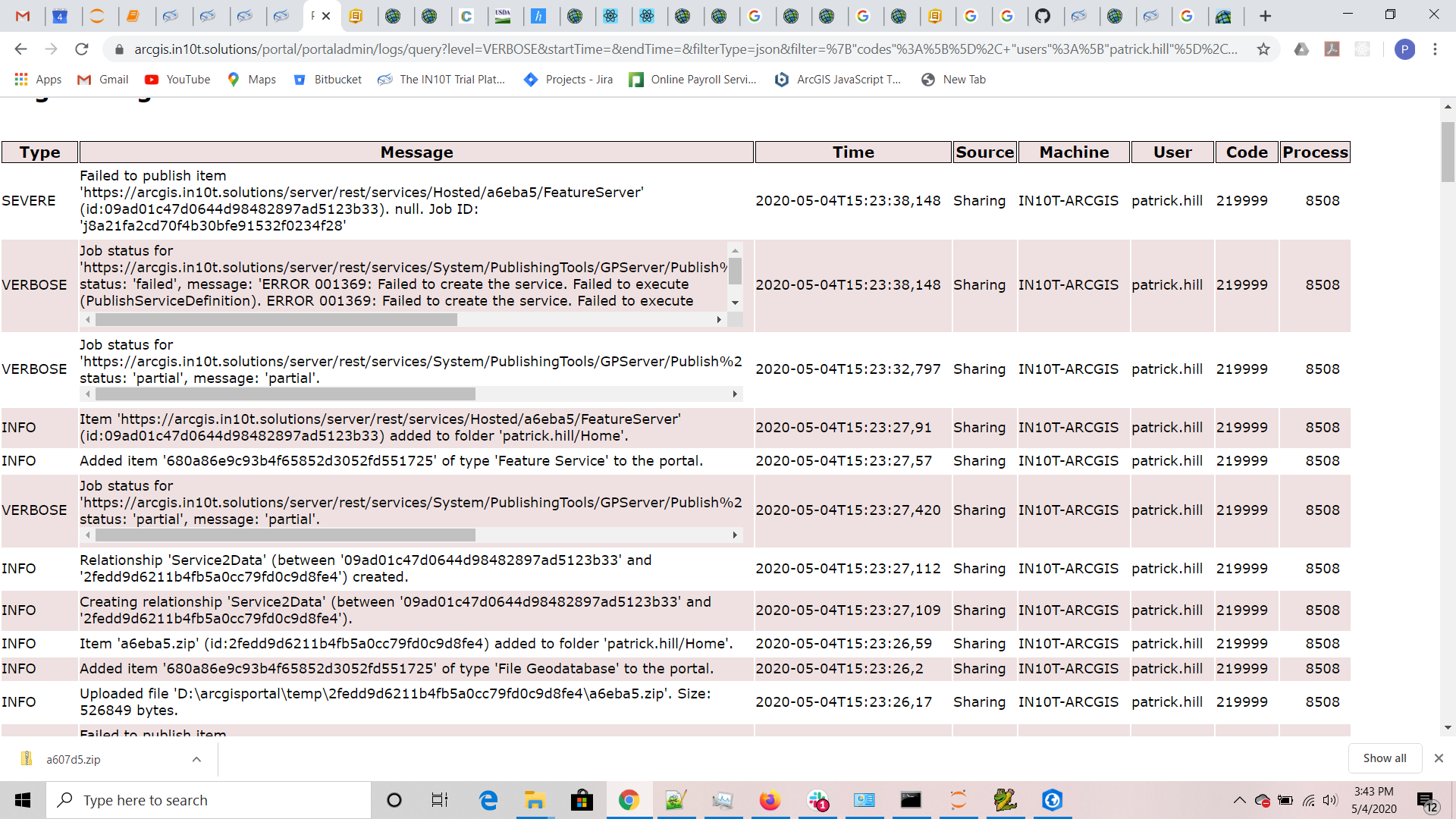
Looking at the portal logs I am getting ERROR 001369: Failed to create the service . My general workflow is:
- import csv as spatially enabled dataframe (sedf)
- import states feature class as sedf
- process csv
- merge processed csv derived sedf with states sedf
- publish as feature layer
Here is a screenshot of my portal logs:
Any help is greatly appreciated.
