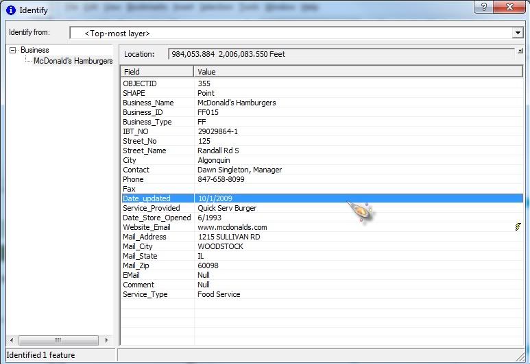
Caitlin, Can you take a screen shot of what you are entering into the widget and post it as well?
<layer> <name>Local Businesses</name> <url>http://server/ArcGis/rest/services/GIS/Community/MapServer/0</url> <expression useforspatial="true">upper(business_name) LIKE upper('%[value]%')</expression> <textsearchlabel>Search by Address [ Example: Buger King]:</textsearchlabel> <graphicalsearchlabel>Use one of the graphical search tools to select incidents</graphicalsearchlabel> <spatialsearchlabel>Select the two layers for spatial query</spatialsearchlabel> <spatialsearchlayer>true</spatialsearchlayer> <spatialrelationlayer>true</spatialrelationlayer> <titlefield>Address</titlefield> <fields all="false"> <field name = "Business_Name" alias="Business Name" /> <field name = "Business_Type" alias="Type" /> <field name = "Website_Email" alias="Website" /> </fields> <linkfield linkfieldprefix = "">Website_Email</linkfield> <icon isfield="true"></icon> <zoomscale>1000</zoomscale> </layer>
http://server/t-assessor.asp?pid=http://server/t-assessor.asp?pid=352585475474
<layer> <name>Parcel ID</name> <url>http://server/ArcGIS/rest/services/Parcels/MapServer/2</url> <expression useforspatial="true">PARCELID like '%[value]%'</expression> <textsearchlabel>Search by Parcel ID [ Example: 350736600508 ]:</textsearchlabel> <graphicalsearchlabel>Use one of the graphical search tools to select a Parcel</graphicalsearchlabel> <spatialsearchlabel>Select the two layers for spatial query</spatialsearchlabel> <spatialsearchlayer>true</spatialsearchlayer> <spatialrelationlayer>true</spatialrelationlayer> <titlefield></titlefield> <fields all="false"> <field name="PARCELID" alias="PARCEL ID" gridfield="true" gridfieldonly="true"/> <field name="PHOTOS" alias="PARCEL INFORMATION" gridfield="false" gridfieldonly="false" hyperlinkgridfield="true" hyperlinkaliastext="Assessor Information" linkprefix="http://server/t-assessor.asp?pid=" linksuffix=""/> <field name="SITUS" alias="SITUS" gridfield="true" gridfieldonly="true"/> <field name="DEEDED_ACR" alias="DEEDED ACRES" gridfield="true" gridfieldonly="true"/> <field name="TAXPAYER_N" alias="TAXPAYER NAME" gridfield="true"/> <field name="MAIL_ADD_1" alias="C/O" gridfield="true" gridfieldonly="true"/> <field name="MAIL_ADD_2" alias="MAILING ADDRESS" gridfield="true" gridfieldonly="true"/> <field name="MAIL_ADD_3" alias="CITY/STATE" gridfield="true" gridfieldonly="true"/> <field name="ZIP_CODE" alias="ZIPCODE" gridfield="true" gridfieldonly="true"/> <field name="LINK_JPG" alias="PHOTO OF PROPERTY" gridfield="false"/> </fields> <linkfield>LINK_JPG</linkfield> <icon isfield="true"></icon> <zoomscale>10000</zoomscale> </layer>
_data = ObjectUtil.copy(value);
Dustin, I am still struggling to reproduce your issue with the viewers url getting added to you link. Unless I can reproduce it, it will be hard for me to diagnose and resolve...
Los miembros registrados pueden publicar, seguir actualizaciones y más. ¿Nuevo aquí? Regístrate gratis.
Find useful guides, FAQs, and documents to help you navigate and make the most of Esri Community.