I am working on Agisoft Photoscan/Metashape a lot and it requires me to input the x,y,z on their field list...
So Before I transfer the x,y, z, from ArcGIS Pro to Agisoft Photoscan/Metashape.
First, I started to plot the markers on 2D to get the x, y using the Insert tab and select the Points Map Note from the Layer Templates list.
So when I add all the points on that layer "Points Map Note" and populate the x,y and z .
Then when I am done with plotting to the project, I went to the View Tab and hit the Convert button to open the 3D Local Scene.
I know the Z value is blank but How do I update the fields ?
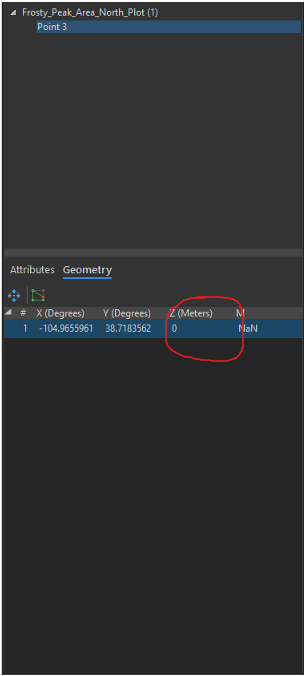
Is there a way around for me to do this to update the Z (Meters) ?


