I need to update an old script that uses ArcIMS and ArcXML into modern day python and arcpy. This script runs in perl, but the part I need to recreate has to do with creating graphics layers on the fly. Given some lat/longs, how do I create them as points, then draw lines between them, and then symbolize them how I want?
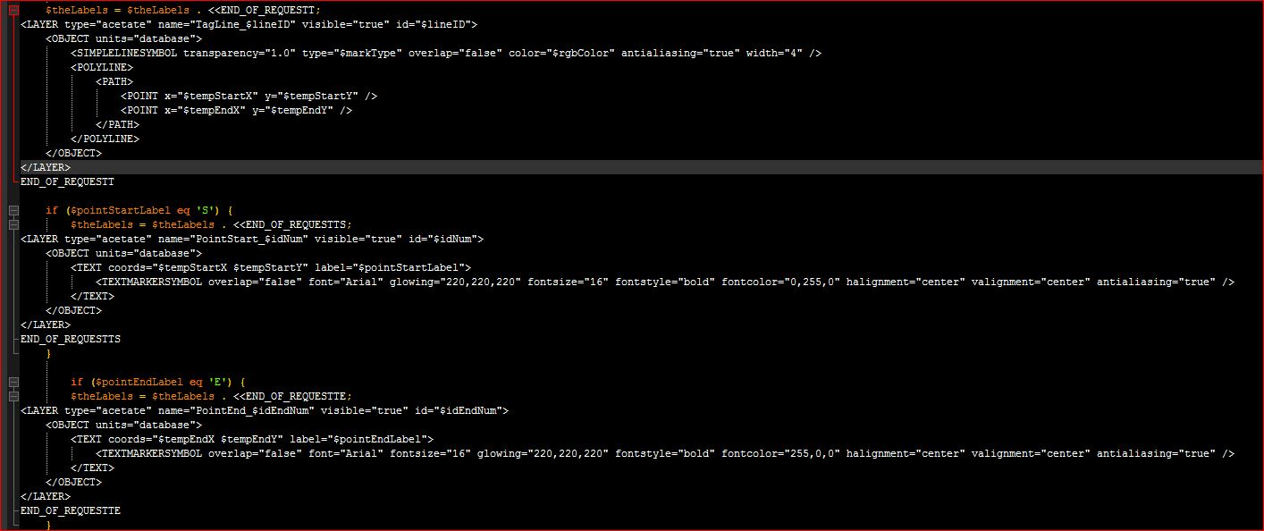
In perl, I create the xml I want, then send it to the server pretty easily as seen below:
In this code I create the points and lines based on an array of lat/longs
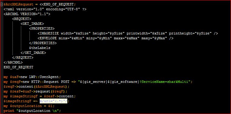
Then I send the request to the arcims server which is hosting a basemap that these are drawn on and export a jpeg:
This seems much harder than it should be in python. The script I've come up with so far is below. It creates a points layer and adds it to an existing map (which works fine), but I cant change the symbols. Basically I just want to use a text letter for each point. The other tricky part will be creating the lines from it. I will use the script and tool in arctoolbox, but this is really a ton more work and I still don't know how to change the symbols. The only idea I came up with is to add a dummy layer that is symbolized how I want but turned off, then apply that symbology to the newly created letters. But that won't give me the dynamic creation I need. (These scripts do a bunch more, I just tried to simplify it here.) At the end it exports a jpeg of the map.
import arcpy
import os
import uuid
arcpy.env.overwriteOutput = True
templateMxd = r"C:\location\to\my\mxd.mxd"
mxd = arcpy.mapping.MapDocument(templateMxd)
# list of lat/longs
ptList = [[-82.1, 29.51], [-80.07, 31.13], [-82.97, 31.96], [-86.12, 27.71], [-82.9, 25.25]]
pt = arcpy.Point()
ptGeoms = []
for p in ptList:
pt.X = p[0]
pt.Y = p[1]
ptGeoms.append(arcpy.PointGeometry(pt))
tempPoints = os.path.join(arcpy.env.scratchGDB, 'tempPoints')
arcpy.env.workspace = arcpy.env.scratchFolder
arcpy.CopyFeatures_management(ptGeoms, tempPoints)
arcpy.MakeFeatureLayer_management(tempPoints, "Start_Points")
arcpy.SaveToLayerFile_management("Start_Points", "Start_Points.lyr")
tempPointsLayer = os.path.join(arcpy.env.scratchFolder, 'Start_Points.lyr')
addLayer = arcpy.mapping.Layer(tempPointsLayer)
df = arcpy.mapping.ListDataFrames(mxd, 'Layers')[0]
arcpy.mapping.AddLayer(df, addLayer, "TOP")
lyrExtent = addLayer.getSelectedExtent()
df.extent = lyrExtent
output = 'WebMap_{}.jpg'.format(str(uuid.uuid1()))
Output_File = os.path.join(arcpy.env.scratchFolder, output)
# Export the WebMap
arcpy.mapping.ExportToJPEG(mxd, Output_File, df, df_export_width=500, df_export_height=500, resolution=150)
# Set the output parameter to be the output file of the server job
arcpy.SetParameterAsText(1, Output_File)
del mxd, addLayer, lyr

