Is it possible to hide scale-specific Layers from users within the Layer List Widget? For instance, I'm using ESRI's Diversity Index map in my WAB Mapping Application, and currently, this is what users see when expanding the Index's layer in the Layer List:
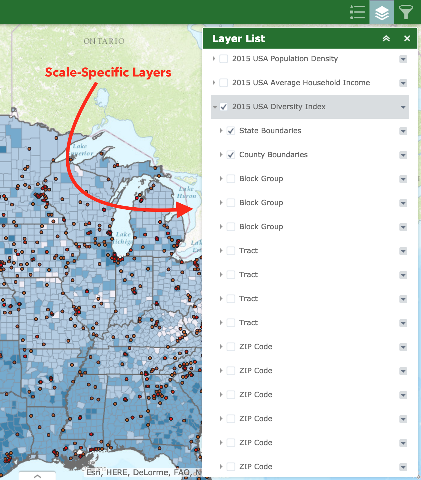
Is it possible to consolidate, or even hide these repetitive layers - i.e. Block Group, Tract, etc? I realize each layer is critical for the proper scaling of the Diversity Index Map Layer. However, allowing users to see this level of detail seems like it will just cause confusion. Any potential solution to this?

