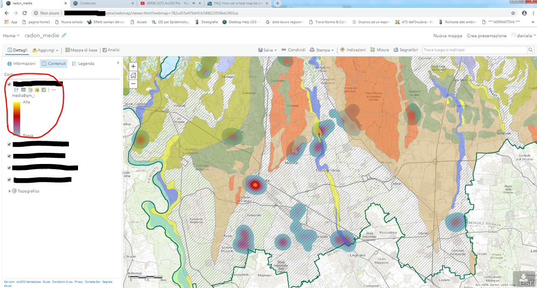
Don't know if it happened to someone else, but I recently tried the heat map functionality in AGOL to style a point layer in a web map, but the result is always in background with respect to the other layers, although it is the uppermost in the TOC. Any idea why this is happening?