I'm getting invalid LAT ranges when using ANY data in Arc SDE, Geography Data Type. Perhaps this is ignorance? To reproduce:
- Create, in Arc SDE 10.2.2, any SQL version, a polygon feature class with GCS NAD 83 as the coordinate system, Geography as the spatial/storage type.
- Load ESRI US States Shapefile into the Feature Class using the Arc Catalog "Load" tool;
- Observe how the States can be previewed in the Arc Catalog preview dialogue;
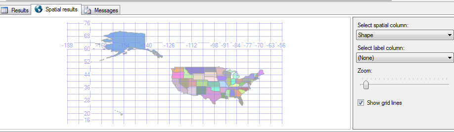
- In SSMS, query the table and select "Spatial Results". Note how SSMS shows the US States;
- If there was invalid geography, SSMS WOULD NOT show the states!
- Add the same data to Arc Map;
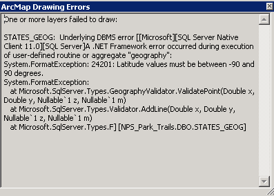
- I've tried every sql geography validator there is, and this data passes. There are no latitude values that fall between -90 and 90. Nor are there null latitude values in these data.
- Tried on numerous computers with SQL native client 10 or 11, same error;
- Same error on SQL 2008 R2 or 2012 SP2
- It seems like ArcMap is pivoting the lat/lon translation? How is this possible?
Either this is a new "feature" of 10.2.2 or I celebrated Columbus Day way to hard and I'm missing something obnoxiously obvious.


