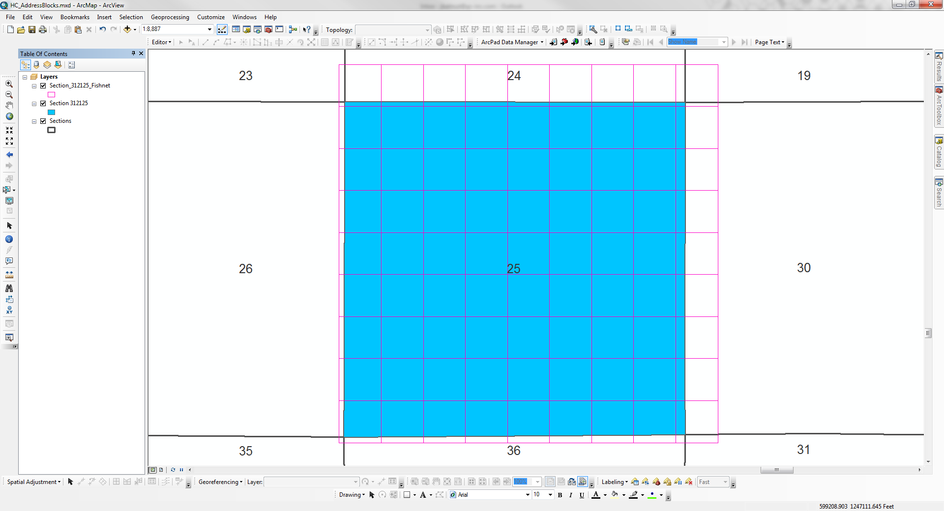
Procedure: Create a fishnet using a single PLSS Section as the template extent feature
Issue: The origin point of the resulting fishnet is always offset to the southwest regardless of how the origin point coordinates are input - automatically through Template Extent or manually.
Environment
ArcGIS Version: 10.0 SP 5 and 10.3
Coordinate System: NAD_1983_StatePlane_Florida_West_FIPS_0902_Feet
Data Frame Display: Feet
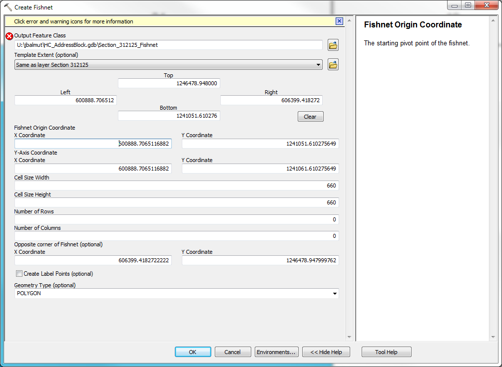
Create Fishnet Geoprocessing Window
Fishnet Results