We're currently in the process of updating our applications to meet WCAG accessibility standards and are reviewing all of them as part of this effort.
One challenge we’re facing is determining which accessibility issues we can resolve ourselves and which fall under Esri’s responsibility. For example, we’ve encountered issues with the address search functionality (address details removed from image for privacy).
- Has anyone else run into similar challenges?
- How are you approaching this process?
- Will Esri teams review and compile these issues and provide guidance on fixes for users, or will this fall entirely under their purview?
Any tips, best practices, or insights would be greatly appreciated!
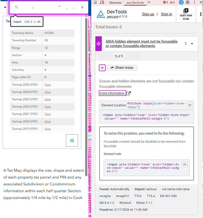
Edit: Adding link to application and steps to reproduce.
https://maps.cookcountyil.gov/taxmapviewer/
1. open app
2. enter pin or address on left pane search bar. ex: 69 W Washington St, Chicago, IL, 60602, USA Selecting an option from drop down will not always trigger it.
2a. type in address and hit enter
3. run accessibility tool. We run axeDev browser extension

