We are currently testing whether ArcGIS Pro could replace both SMS and HEC-RAS for us, and I have noticed a problem. There is an option called “Contain water within the area of interest,” which can be set in the configuration.

I understand the description to mean that activating this option prevents water from flowing out of the defined simulation area, while deactivating the option allows water to flow out of the defined area as normal.
We simulated both settings and, strangely enough, came up with the following result:
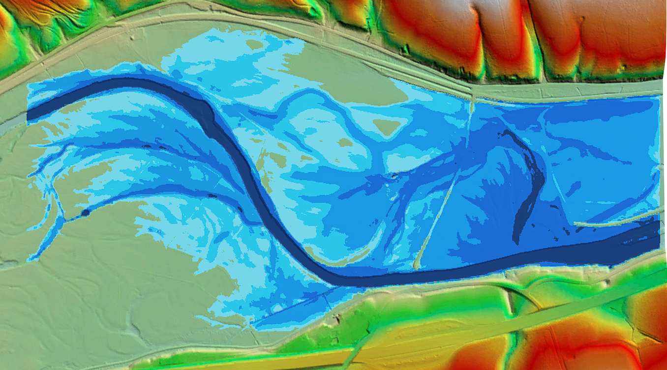
This is what the simulation looks like when we disable the option so that the water can flow out:
And this is what it looks like when we enable the option so that the water is NOT allowed to flow out of the area:
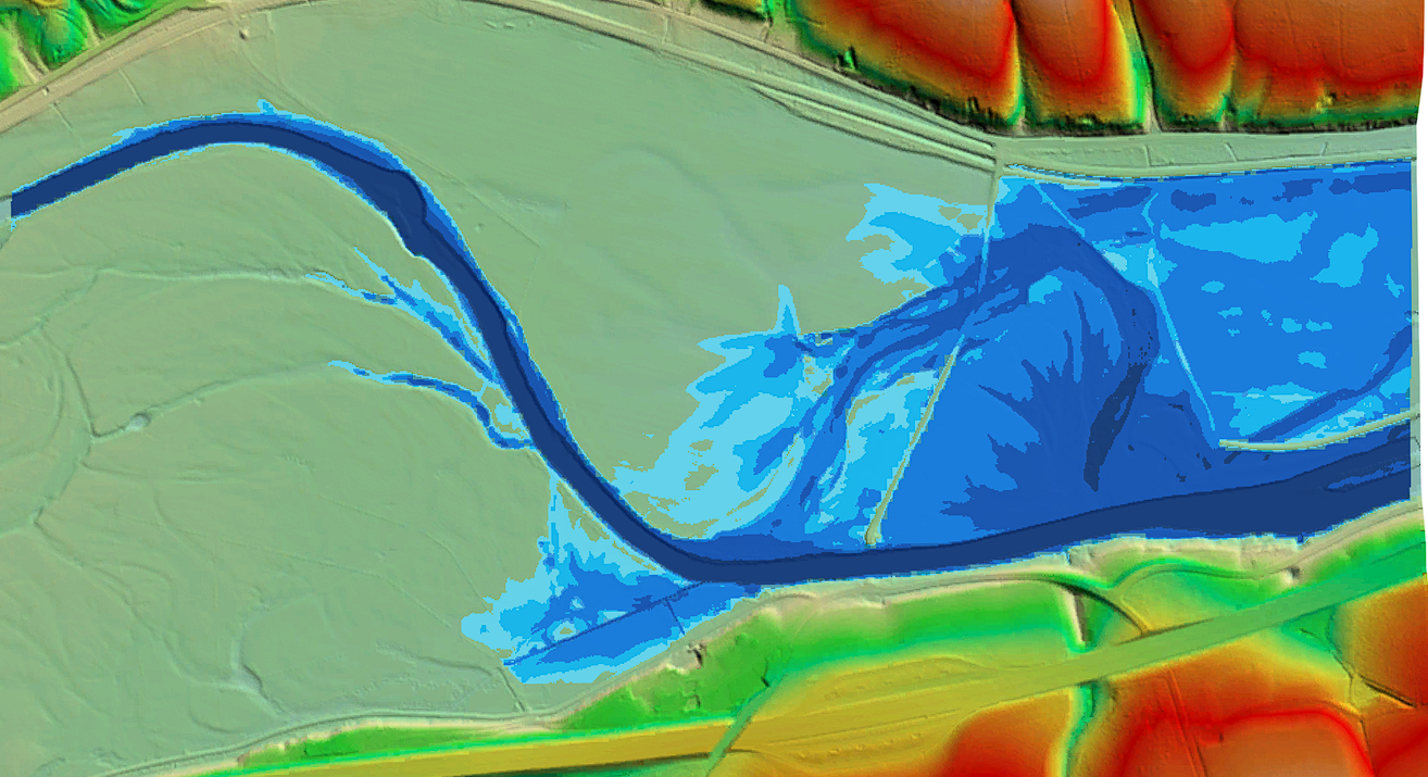
According to my logic, the result should actually be the other way around, i.e., if I do NOT let the water drain away, the water should accumulate in the simulation area. However, the result is exactly the opposite.
With the water draining away, I have a maximum water depth of 14 meters, whereas without drainage it was only 4 meters.
Am I misunderstanding how it works? Or does this actually seem to be a bug?
As a test, I made the simulation area on the right larger than the DGM, which forces the water to drain off into nothingness on the right. But there I got a completely different result, which I can't really explain either, since the result should actually correspond to the result with drainage.:
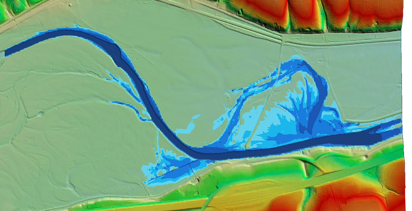
Can anyone reproduce this error?

