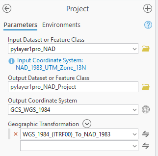
In Pro 3.4.2, I'm projecting from NAD 1983 UTM Zone 13N to WGS 1984 in the above image. The first geographic transformation (selected above) that appears in the dropdown seems backwards. The rest of the dropdown items seem to go in the right direction, starting with NAD 1983. Has anyone encountered this?
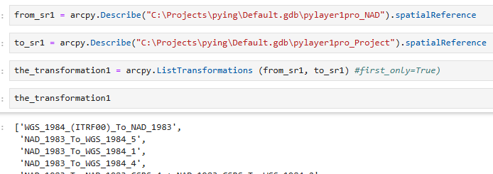
You might say "why don't you just double check the transformation before running the tool then, and flip it if you need?" Long story short, I'm trying to create a Python script. Part of it projects a layer of previously unknown spatial reference to WGS 1984, and it is a problem that the first listed transformation is incorrect. When I run arcpy.ListTransformations the same issue does exist (see below).
Per documentation, "usually" the first item is the transformation you want to project with, so I was originally going to trust that in my code. I'm wondering how common this is across other spatial references, is it a glitch, or am I missing something silly? Or should I just not be projecting things with ArcPy unsupervised (that may be a question for a different board)?