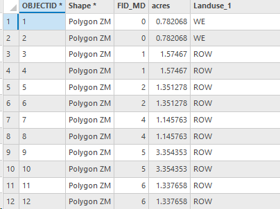
I am using intersect to join 4 different shapefiles. the four names of the shapefiles are Ownership, Disturbance, Sections, Respread. When I combine ownership and disturbance i check my acres at 5155 total acres. When i combine disturbance and sections i get 10,xyz. When i look into what caused this issue it shows that some areas are being counted more than once. So in the ownership/disturbance table i have one result for "Area 1" but when i look at disturbance and sections together i may have 2 or 3 results for "area 1".
I have my Acres/Ownership/Landuse in one shapefile, then i need to add sections and respread in that shapefile to have a complete file. i have the data just cant get it together. Maybe there is a better tool.
Something must be wrong with my section shapefile. Any help is appreciated