I am writing a script to convert CAD file into a format viewable in ArcGIS. I am using arcpy.CADToGeodatabase_conversion() for this purpose.
In my source CAD file, I have a variety of line types that are all different, like so:
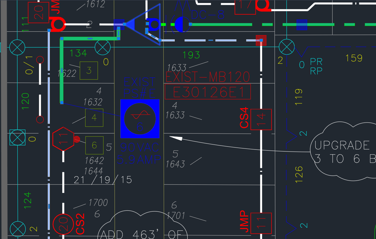
However, after running the function above and converting to a geodatabase, the same area has lines that are all homogenous:
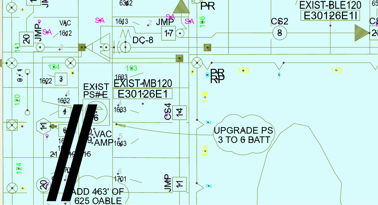
Notice how the coloured and different shaped lines all have changed to be the same type of line in the ArcGIS feature class.
I'm new to both ArcGIS and AutoCAD. Is there a different function I should be using to convert CAD files to be viewable in ArcGIS and preserve the line types? Any guidance here would be appreciated. Thank you!