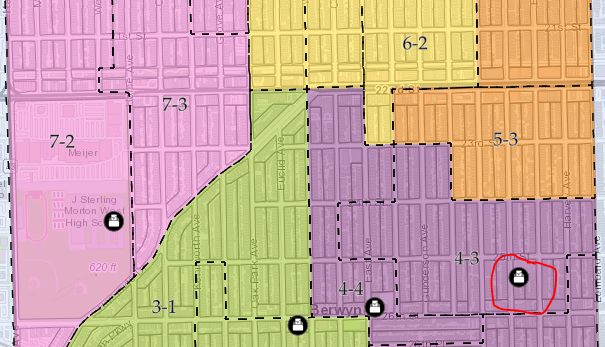
I have 2 different data sets, one is a polygon feature layer for election precincts, and the other is a point layer for polling places. I would like to make it so when the polling place is selected, the polygons for the corresponding election precincts flash. Conversely, I would also like the corresponding polling place to flash/highlight when the election precinct is selected. This is a web map but I make most of my edits by opening the project in ArcGIS Pro. I have heard about using Arcade to configure popups, could I use arcade to highlight/flash these features?
I attached a screenshot, so for example the circled polling location corresponds with 5-3 election precinct. Therefore, when that polling location is selected, the 5-3 precinct would flash/highlight. Additionally, if the 5-3 precinct was selected, the polling location would flash.
Thanks in advance for any help.