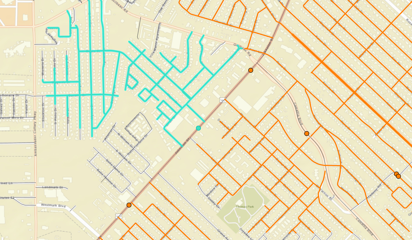
I am using our cities centerline feature layer and merged our bike route feature layer. I have run topology and fixed the errors that it found. What we are trying to do is find which portions of the new bike route give the most access to local roads. The facility points in the analysis are the acutely center point of each new bike route segment. We run the service analysis from that facility point, the cutoff is 1mi, the buffer is 1000ft, I have set restrictions to prohibit access to major collectors, major arterial roads and interstates. There are no field that indicate street direction in our database. But when i run the analysis it appears to only show the service area on one side of the street, not both even if the adjacent street is directly across from the facility point. i have attached a screenshot. blue indicates the streets included in the analysis for that point, but you can clearly see streets directly across that are not included. If I use the complete set of centerlines (no restrictions) it will show service area on either side of road.
do you think there is something wrong with the dataset, the restrictions, etc....