I'm going to preface this by saying I am well aware that Personal Geodatabases are not supported in Pro. Please do not tell me that they are unsupported, I know.
That being said.
In Personal Geodatabases you can make managed and unmanaged raster catalogs, the difference being whether it copies the rasters in the database (managed) or stores a reference (unmanaged). In V10, you can also make mosaics, which are also "unmanaged".
My question is: How can I tell which file it's referencing by looking at the tables in the MDB?
In Version 9 (only has raster catalogs):
SpoilerIn the GDB_RasterColumns table, it shows I have a managed (testcatman) and unmanaged (testcatunman) raster catalog. Note: They have the exact same component files.

Opening the table for each one, the managed one lists the component files, while the unmanaged one has a record for each file, but it's completely blank.
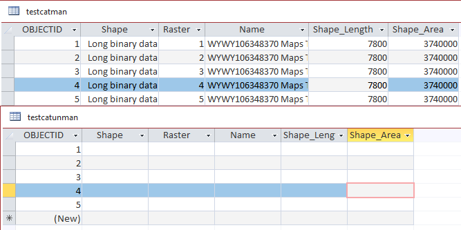
V10:
SpoilerIn V10, I have a managed, unmanged raster catalogs, and a raster mosaic (AMD_testmos_conv_CAT)

It doesn't look like we have the same problem with raster catalogs as we did in V9:
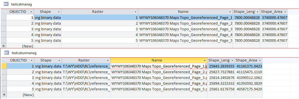
However, the mosaic does not have a nice file path for the files; it instead has that information in a binary field.

Is there an easy way to get the path, or do I need to parse binary?
Thanks!
