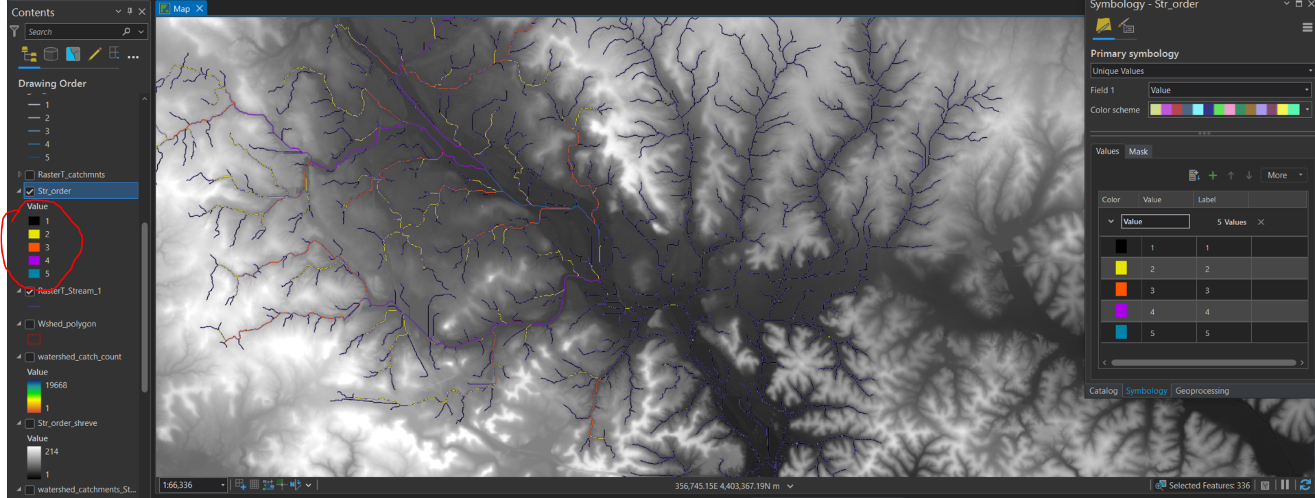
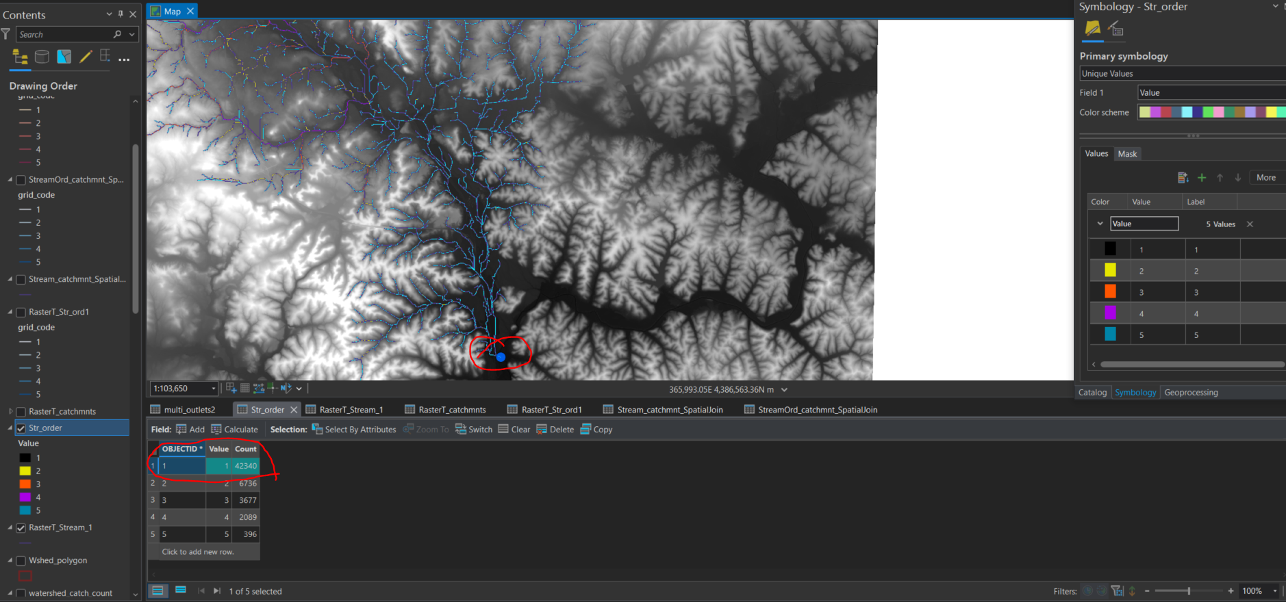
I am delineating a watershed and have produced a stream order raster. I used the Stream Order tool with a stream link raster as the input stream raster and the flow direction raster as the input flow direction raster. As you can see in the screenshots. The second screen shot is to show the outlet point and the selection of all the #1's. Why has it grouped so many streams that seem to be of a different order into #1?