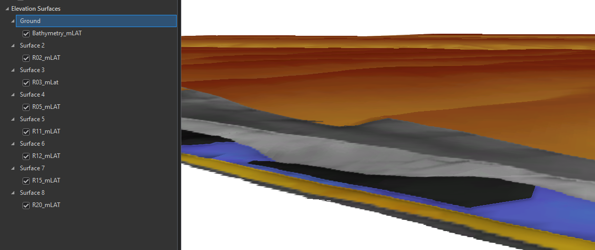
Is it possible to display multiple raster elevation surfaces like the image below in a 3D online scene using JavaScript? I'm currently working on this and would like to know if anyone has experience or advice to share.
I have only attempted ArcGIS Maps SDK for JavaScript so far, with no luck.