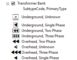
I'm in local government as an analyst for a public electric utility. I'm new to the ArcGIS for AutoCAD extension (and CAD in general). I believe I pretty much have the workflow for our city's distribution designers figured out, but I wanted to know if it was possible to symbolize Web Feature Layers based on subtypes and domains. For example, our transformers in GIS are symbolized based on a field with a subtype of Overhead or Underground and another field with domains for number of phases.
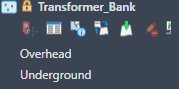
When the data is pulled into ACAD using the extension it only shows the subtype field as 'separate' layers.
I checked the REST endpoint and it shows up properly on that end which made me think this may not be possible. If it isn't, is there a possible work around? Our designers symbolize based off of those parameters.

