Hi,
So typically I fly manually and take pictures at all sort of different angles, distances, etc. for calculating volume on gravel and asphalt that we stockpile. I thought I'd compare the same pile using a crosshatch survey and the results were quite different.
Are there any adjustments to the settings in Site Scan I should use for attaining more accuracy? Using crosshatch would definitely save time on these larger sites with multiple piles to drone.
Here is what I got via Crosshatch:
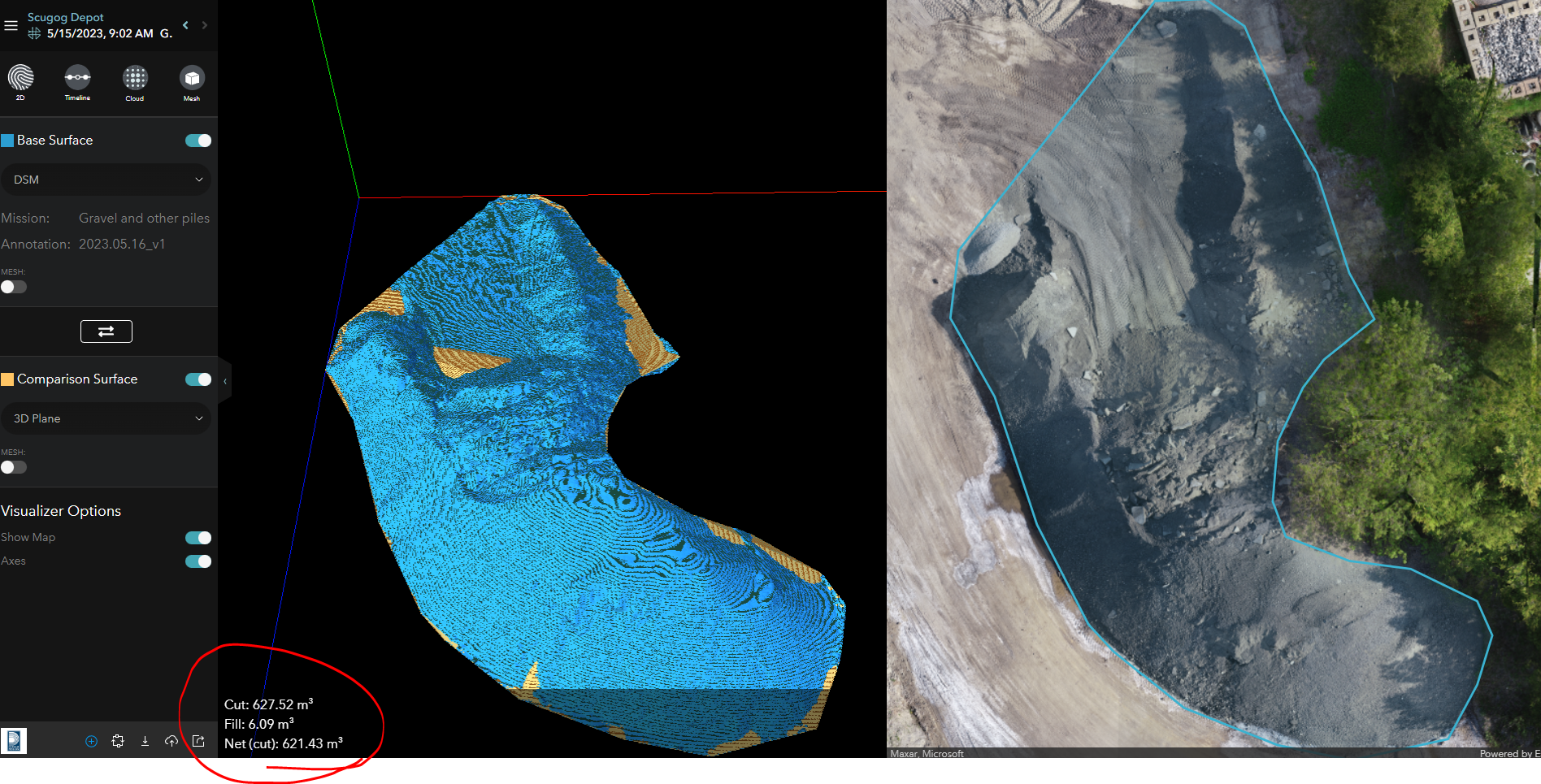
And here is what I get flying the drone using a "Point of Interest" pattern in DJI Go 4, combined with manually flying some pattern over it as well.
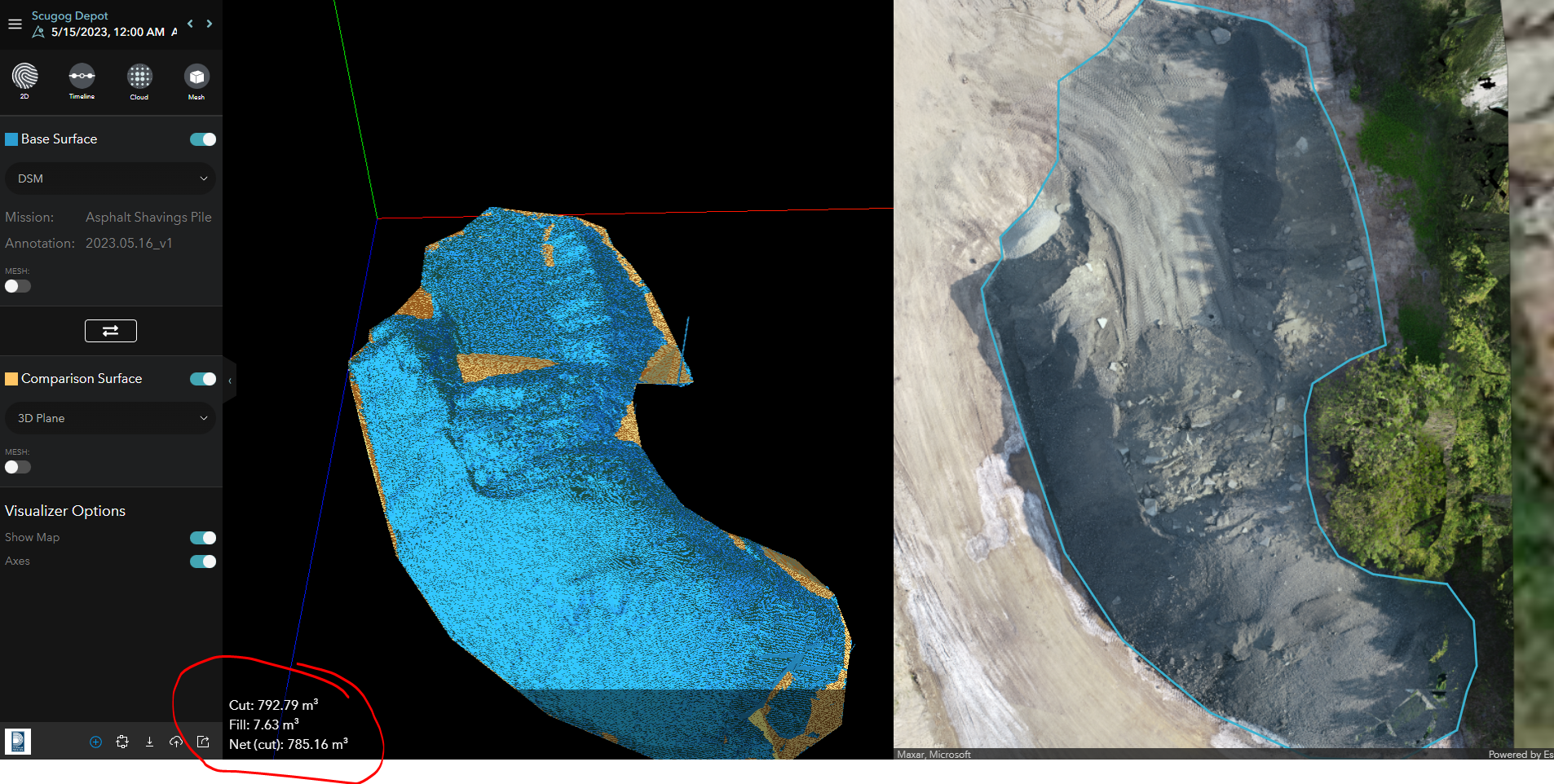
Over 150 cubic meters difference is signifigant for what is a fairly small pile.


