I have got two feature classes:
1) The location of multiple bore sites as vector point data
2) The location of overlapping geological units as a single vector polygon feature class
Both FC have multiple data fields
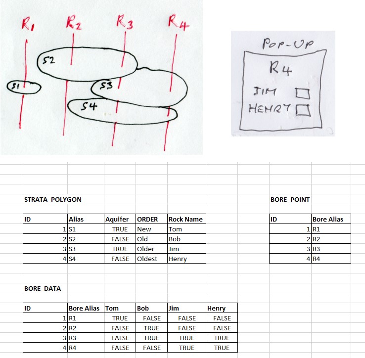
I'm working on a map that will enable me to click on a bore and display data from bore dataset and data from the geological units it intersects.
I have been attempting to write some python/arcpy code to create a single excel file (shown as 'Bore_Data' in the image) which contains all the data - but have been running into issues with the many-to-many relationship.
I'm attacking this via spatial joins to a virtual FC and tacking on more and more fields and finally exporting this as an excel file.
Having all the data in one file would be ideal as I want to do some statistical analysis of the data as whole.
Am I approaching this task the right way - or is there a more elegant to consolidate the data?
Any advise would be helpful.


