I was watching a tutorial in a related topic and they utilized the following image.
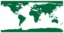
I am wondering, can I generate an image of the earth in this format (flattened out) from an MXD? If I grabbed data from multiple sources (let's say polygons for example) and brought in a world map (basemap or otherwise), could I then export an image file (pdf, gif, jpg, png, etc) from that output?


