Hello all,
I have been attempting to classify 0.5 m imagery for my research. Unfortunately, when I go to run the "classify pixels using deep learning tool", I get an output with no errors, but the raster is seemingly blank.
I have collected extensive training points on all of the various land cover/habitat types of interest, exported the training data for deep learning, and trained the deep learning model. The following are my specifications for the "train deep learning model tool"...
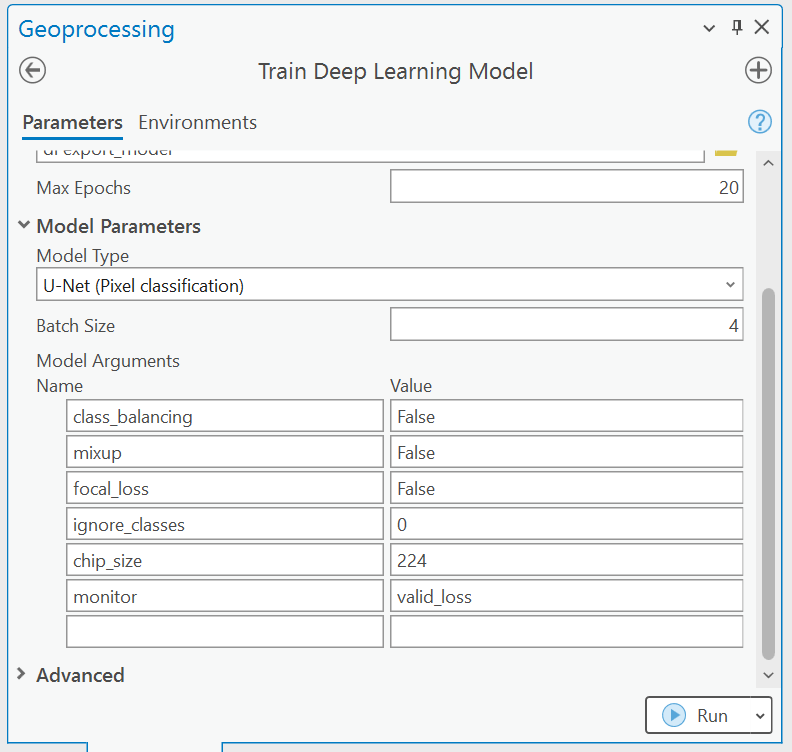
I have also run this with the Deeplab model (which is what I initially planned on using) with the same outcome. I subsequently run the "classify pixels using deep learning model" tool, using the .dlpk file that I get as output from the previous tool. The following is the raster info from the image I want to classify...
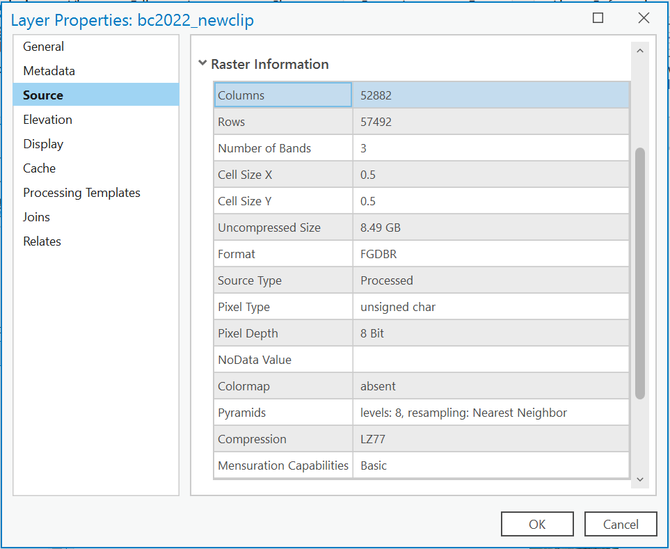
It appears as though the output raster that is supposed to be my classified image has pixels that have values of either 0 or 255, but when displayed on my map, it seems completely blank.
Other questions I have seen about this say to make sure your image is 8 bit unsigned, which mine is. I must be missing something here, this has been a very "learn as I go" experience, so any help would be much appreciated.
P.S. I'm working with ArcGIS Pro 3.0.3 and have downloaded the required deep learning libraries associated with the tools that I am using.



