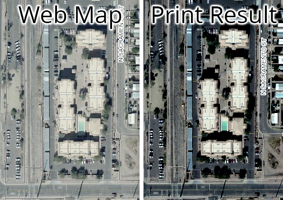
Our PrintingTools geoprocessing service in ArcGIS Server 10.8.1 is applying some kind of default stretch to raster imagery whith Export Web Map tasks from the print widget in a Web Appbuilder (Developer Edition v2.18) app. The web app displays the aerial from an image service (published from a mosaic dataset) in a basemap gallery widget. The raster imagery is displayed correctly in the web map and app, but the output from the print widget makes the imagery look much darker. This impacts readability with the symbology of other layers. Is there a way to control the raster symbology stretch like what can be done from within ArcGIS Pro and ArcMap?