Hi and tagging @RobertScheitlin__GISP ,
We put a elevation profile widget for experience builder using
https://developers.arcgis.com/javascript/latest/api-reference/esri-widgets-ElevationProfile.html

and what we have encounter is the although the query from the elevation layer is returning z value up to 13 decimal point,

The chart is rounding the Z value to 1 decimal point. This end up with elevation profile looking like steps.
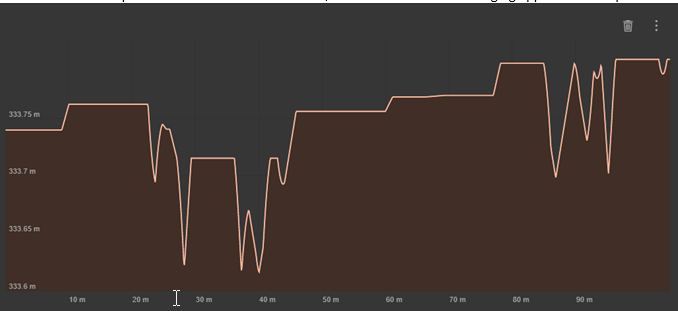
What we are after is very granular and detail elevation, rounded to 3 decimal point instead of 1 which would look like the below.
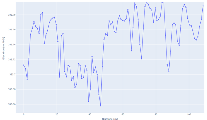
I don't see any options to configure the chart precision. I have set the demresolution to the finest + tried 1m as well but I am still getting the rounding off to 1 decimal point, therefore steps in the elevation profile. The area we are looking at is flat (Farm land) and having these precision is important. Can anyone advise if there is a way around it or advise on any workaround

