Hello All,
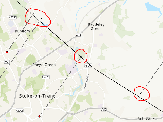
I ran a least cost path analysis from points to polylines in Pro. At first it looked great, but when I zoomed in, all of the resulting paths either overshoot or undershoot the line features. Overshooting is fine, but they need to at least touch the target lines. Any ideas what could cause this? (the paths also seem awfully straight, but other paths did have some variation, so maybe it's just because England is pretty flat? I used a slope raster from Copernicus as my cost raster.)