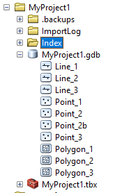
This maybe is simple but what is the quickest way to find out which feature classes hold any data in a database with many classes/tables? (points, lines, polygons) Is there a quick way to analys the geodatabase and visual show which classes contains data? Or a script listing all feature classes and add "data exists" in a text file.