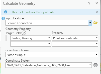
I have a Water Utility Network AND a Sewer Utility Network Set up. I have added an easting and northing field to both Networks under my Devices and Junctions.
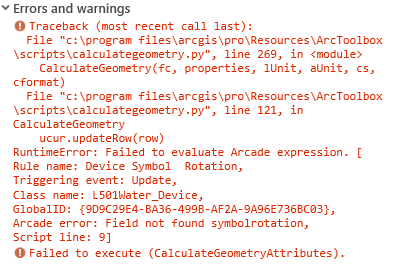
I'm trying to run the Calculate Geometry via the Attribute table on a selected feature (s) with the property being the X or Y coordinate in my local coordinate system, however it creates an error against an attribute rule every time. It is pretty much the exact same error in Water as it is in Sewer in both Devices and Junctions.
I could copy and paste the geometry Easting and Northing from the Geometry tab, but I have several to do and this will happen monthly. So if I would be faster if I could just select several at once and then run the calculation tool instead of copying two bearings per point. I also don't want to create an attribute rule for this as I only want the Easting and Northing to be filled out on certain ones and I don't want the field changing if it accidentally gets moved.
In addition I tried this via an exported asset package without the network enabled and the Calculate Geometry works as expected.