Hi All,
Introduction:
I have been moving from working with CGA, and trying to get back into python by getting acquainted with arcpy in order to explore their integration. As a result I decided to go back to a tool I tried to make a while ago, and recreate it in python in order to try to get used to creating geoprocessing tools. So here is my first tool for download, and I hope it works for others like it is working for me.
What is the tool?:
- This tool takes a variable layer as an input and then reclassifies a euclidean distance raster created from it based on the average and standard deviation of the distances the suitability layer is away from variable layer (highest value 9 is everything below the mean, and each value after descends 1/4 standard deviation). The use of this method to create proximity based suitability layers for single utility assignments (SUA) is described in detail in page 108 of Smart Land-use Analysis: The LUCIS Model.
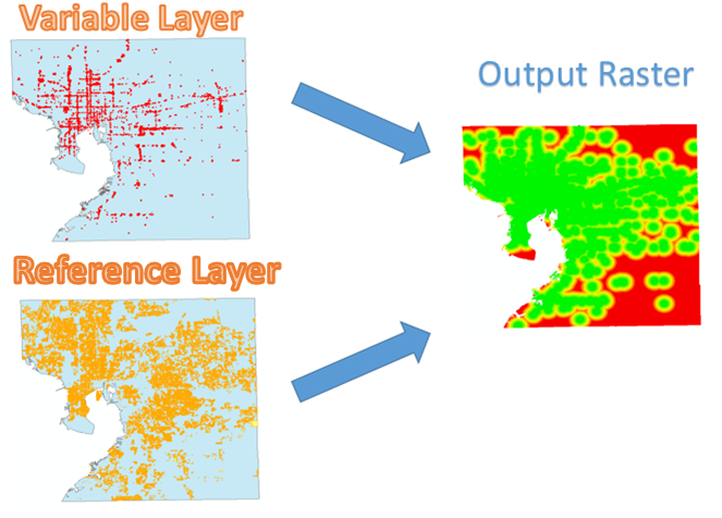
- Tool takes feature layers* as inputs (points, lines, or polygons).
- Output is based on the raster analysis environments set in ArcMap or Model Builder. It is suggested at the very least the extent, cell size, and mask are chosen based on the project.
- The tool uses geoprocessing tools and cursors to retrieve key values that are used to drive the reclassification process. The tool is data driven in the sense that the reclassification is being made based on the relative distance a "reference layer" is from a variable layer. This is actually a very common step in the process of creating proximity based suitability layers for LUCIS, which is a goal-driven GIS model that produces a spatial representation of probable patterns of future land use for the development of different land use scenarios. My main idea is that this could be used model builder to help with suitability layer creation. The scripts remap table can be modified to to use the standard deviation and mean differently to create different reclassifications (getting standard deviations below the mean for example).
- I used the tool on 8 different variables in the Hillsborough,FL region in a batch process, and then did a weighted sum on all of outputs to create a draft and simple suitability raster for single family residential. So here is example output.
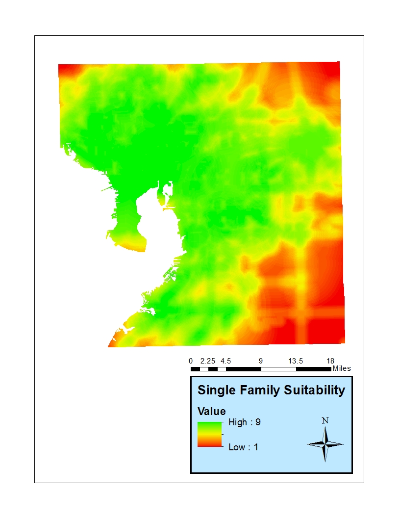
The suitability tool box upload here consists of a script, tool box, tool description document, and sample data. I have tested the tool and got it to work for me within ArcGIS 10.3. File Size ~2-3 MB.
Constructive Criticism Appreciated!:
I was hoping to get constructive criticism on the code and on the tool itself.
I will update when I can.
Thanks,
David Wasserman
Previous work: City planning software jumps on the protected bike lane trend | PeopleForBikes


