A section that is very useful in #AGOL is using Arcade, this allows us to have at hand a myriad of functions that are running with our web map. The best part is that you don't have to be a programmer to make a change that greatly benefits our map.
Symbology sometimes gets complicated because there are many elements and they end up saturating the screen. This is the configuration we want to remove.
We need to have a map made with some element expanding.<\/P>
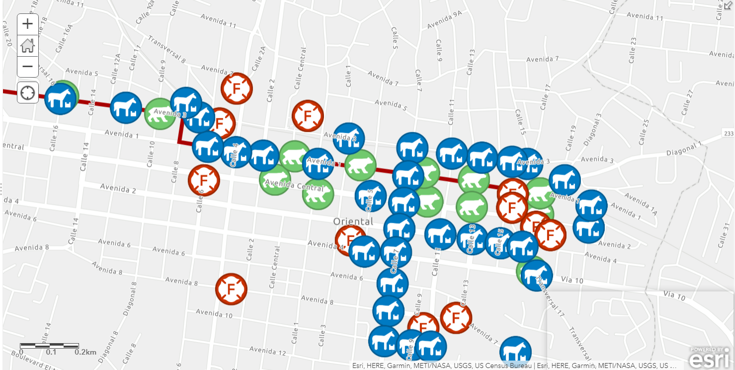
As we can see on this map all points are noticeable at this scale overlapping.
First, in our map we go to symbology  , there we scroll to where the option to select an attribute to display is and option 1 we select "New expression"<\/P>
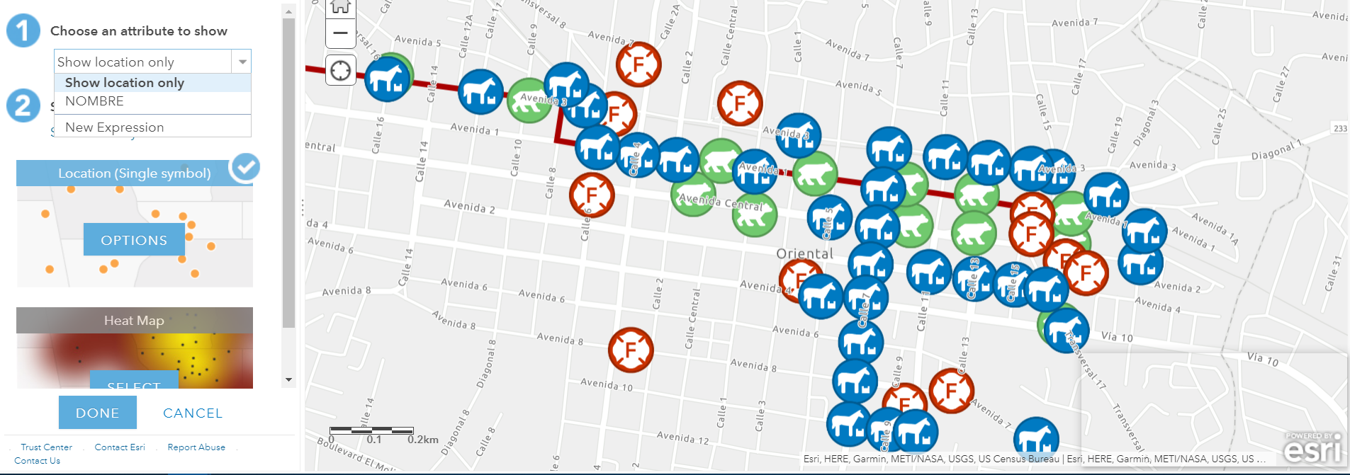
In this case, the symbology has a restriction at 19073, which means after that scale it does not show. What we will do is make the restriction in 2 parts:<\/P>
From 19073 to 4515 with a size of 15 pts.<\/P>
From 4514 to 1 with a size of 30 pts.<\/P>
var vs=$view.scale
When (vs<=19073&&vs>=4515,15,
vs<=4514,30,<BR \/>1)<\/P><\/BLOCKQUOTE>
Here what we say is that we create a variable named vs, so we don't have to write $view.scale every time we need that property.
When vs is <= X and vs >= Y then assign 15.<\/P>
and the rest is if it is less than Z then assign 30.<\/P>
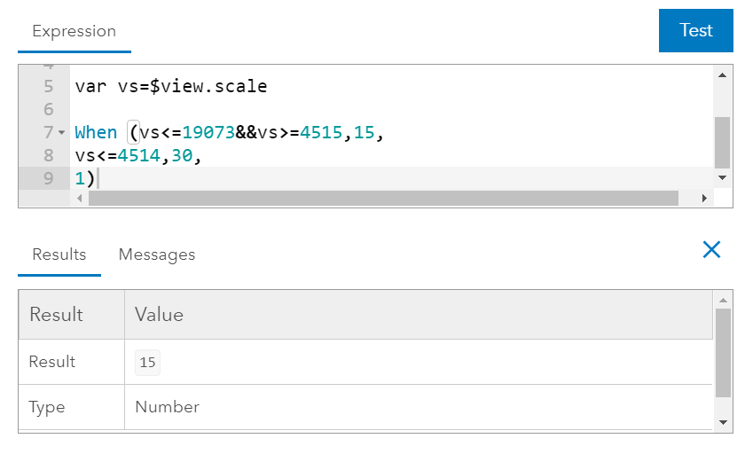
If we press the Test button it shows us the result of this operation. We click Ok save and now we will place the symbol we want.
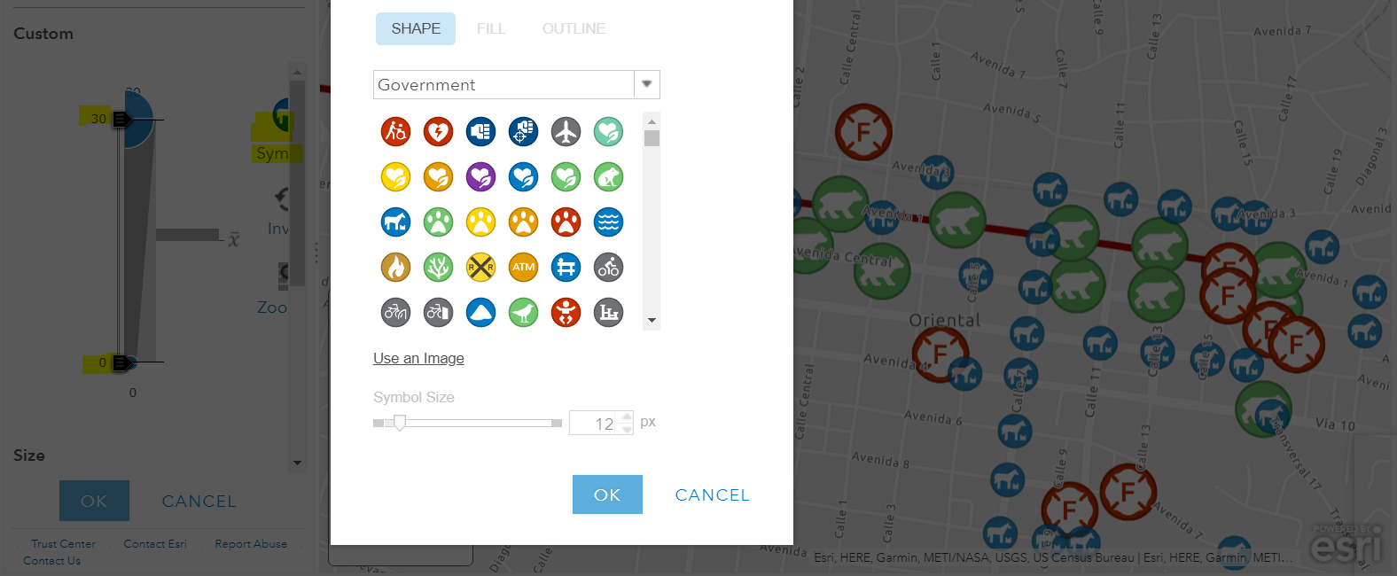
Let's remember that the maximum is 30 and the minimum 0 if it were greater here you can increase that size otherwise it would simply assign the largest size it has. Select the desired element and now we will see the result.
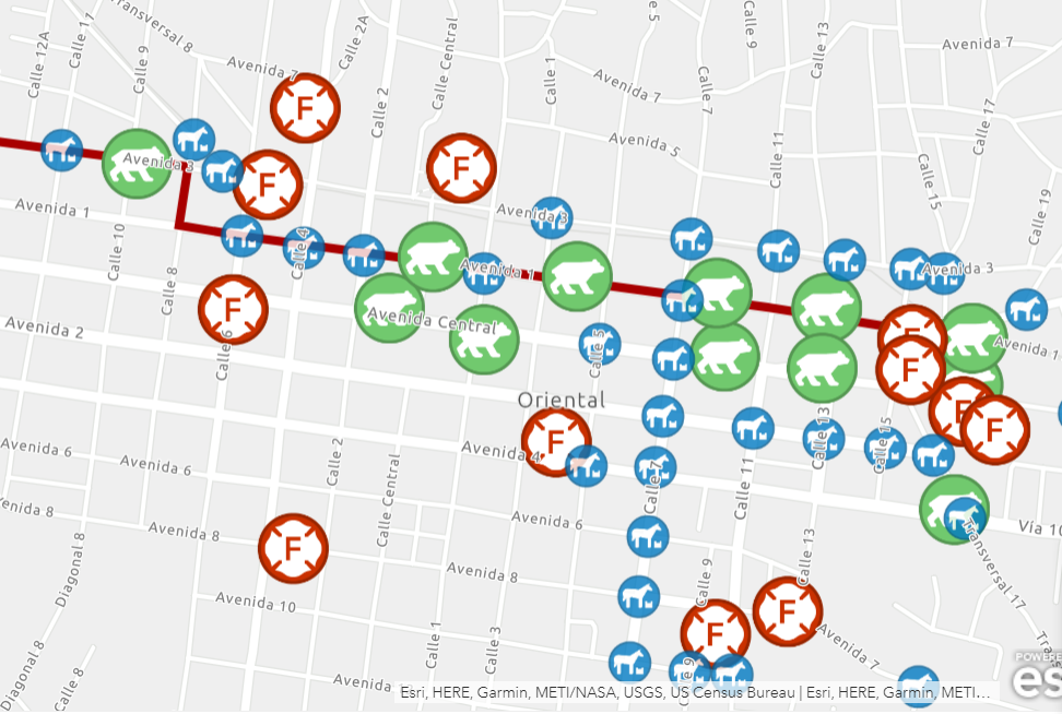
Initially all elements had the same size, now we see how the horses fit better at a larger scale, we must do the same with the other elements<\/STRONG>.
I hope it works for your maps and any questions in the comments.
Extra information for your enjoyment:<\/P>
