Hello All,
Within ArcMap, we could create a custom button, via python, to act as an organized catalog to add features to a map from a geodatabase. All the menu items were neatly organized depending on the category of the feature. This was a nice way to present the data because there is a lot to organize. In addition it would call up the feature class from a geodatabase and utilize the symbology from a specified layer.
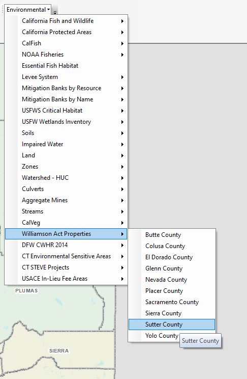
Now i have created a very basic button in ArcPro to call up features from a specified geodatabase, however i can't find any information on how to organize the buttons into further dropdown categories or utilize layer symbology.
 \
\
Any help on code or a point in the right direction would be incredibly helpful and I appreciate your time.
Thanks,
Derek Salinas


