Hello all,
I created a survey with an existing feature service (address points) for building damage assessment. I understood this would be 'geopoint' in my survey, and the survey would not create any new geometry when I am using Inbox to attach the information on these existing points. But it seems I have not fully understood yet.
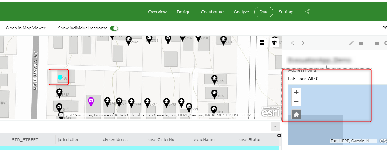
As shown below, the existing points are located on the map (as expected). If I click any record, the address point shows nothing, just 0, 0 lat and long in the summary part (right pane). I am not clear why it does not pick up the actual location as displayed in the map area.
Currently my survey questions are added on the feature service layer, and I have a related table published to accommodate pictures and audios only. If the survey still try to pick up new geopoint location in spite of having data from existing points, should I make all of my survey questions in the related table and make geopoint auto populated based on the existing point's location? so basically create a new dataset with geometry?
Any advice?