To Whom It May Concern,
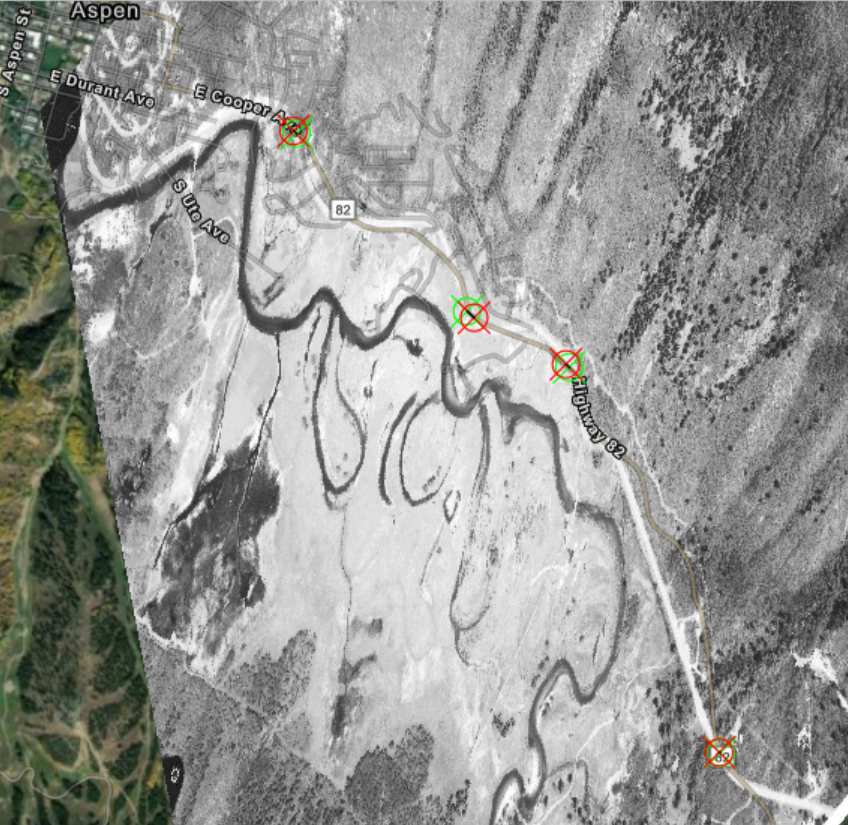
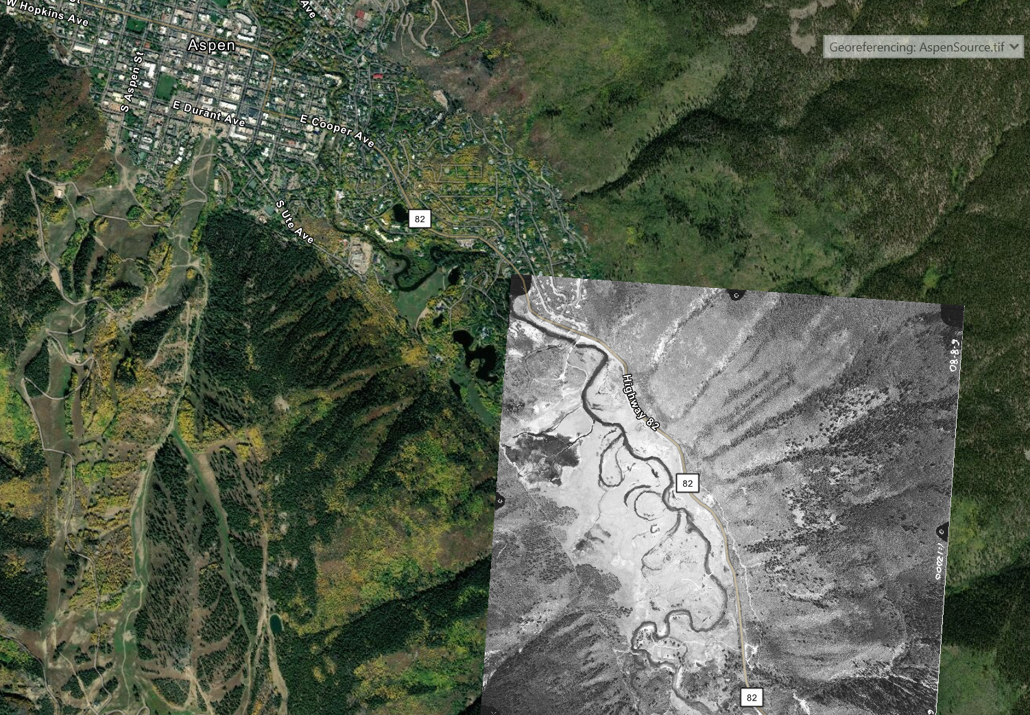
I just wanted to report that this georeferencing tutorial seems to be trying to georeference the raster to the wrong location.
This is where the tutorial is trying to make it fit:
When it should actually be more to the southeast:
In the second part of the tutorial, Compare Transformation Methods, it has the image in the correct location, but a large chunk of the first part might be pretty confusing as it is.

