Hi everyone. I really need your help!
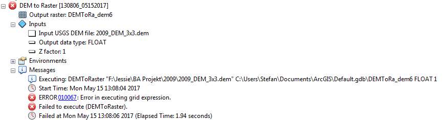
I'm currently working with AdamTech 3DM Analyst, CH 1903 coordinates. Within the programme I can produce a DEM and save it, but afterward there is an error using DEM-to-raster tool in ArcMap. I think it is because of the USGS DEM... Do you have an idea how it should work? Or how to convert my DEM to an USGS DEM?
I attached you a screenshot containing the error.
Many many thanks for all your help.
Send you kind regards and a big thank you.




