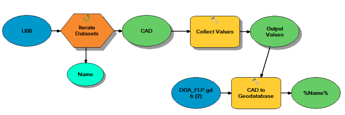
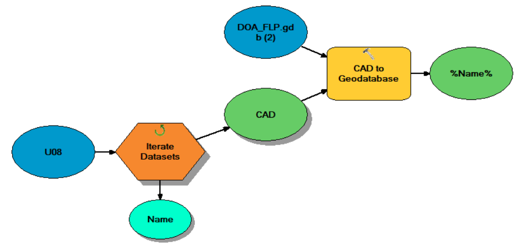
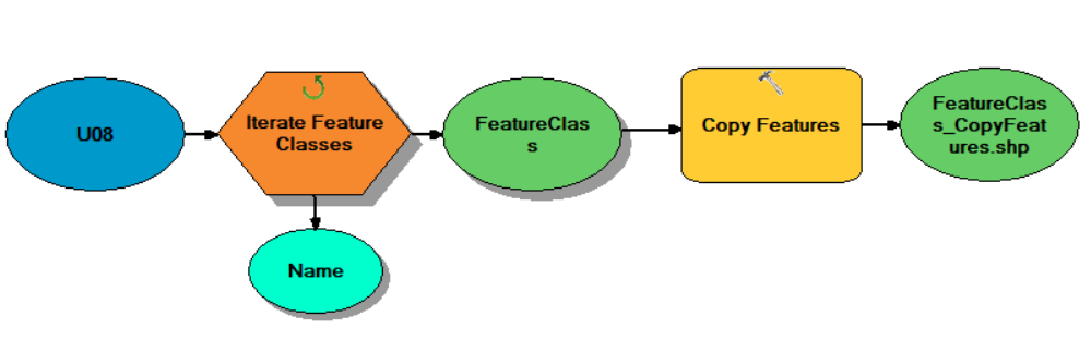
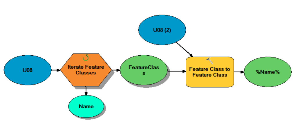
I've tried every way I could find to iterate through a file directory, extract CAD files, and then copy the CAD lines to a geodatabase. I want to avoid having to append each dataset individually to a matching db layer. I tried using a number of tools and combinations of tools and settings, creating new feature classes vs using existing ones. I am using Arc 10.6, and Autodesk 2018.
Nothing works. All I get are errors and empty outputs. I'd like to do this in model builder but wondering if it is even possible? None of these tools seem to do what they say they do. Just a few of the many things I've tried are shown below. Can anyone point me to a workflow that actually works?
Feature Class to Feature Class
CAD to Geodatabase
Copy Features
Copy
Collect Values
Create Feature Layer