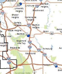
I'm making a simple map of an area with some points that I geocoded, and added symbols. I am using the basemap layers from Business Analyst, and BA's road labels are covering up my symbols. My points are above the BA layers in the TOC and I have updated the feature weight for my points several times to greater values, but BA's road labels always overlap my symbols somewhere on the map. Is there a way to move the road labels off my symbols without changing the labels to annotation and moving them manually? The attached image shows three points partially covered by the road labels.