I am trying to build a global raster at approx 500m resolution in geographic projection (cellsize 0.004167 decimal degrees), where values report the area of each cell in square meters.
I have built a Latitude grid that looks like this, where black is 0 and white is 90

and I applied the formula, which didn't work:
111113 * ((0.004167 * Cos("LatitudeRaster_500m" * 0.017453292)) * 0.004167)
Where 111113 is the length of 1 degree of arc at the equator; LatitudeRaster_500m is the latitude grid reporting the value of latitude of each cell and 0.004167 is the cellsize)
I realized that the problem is with the Cos("LatitudeRaster_500m") that, if run as such, generate a strange raster where the sequence of between -1 and 1 occurs several times like this (while = 1; black = -1)
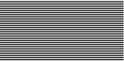
while I was expecting a raster with a 1 in the center, gradually moving to a 0 where the latitude is 90 degrees.
Any suggestion?
Many thanks
Fabio

