Hi,
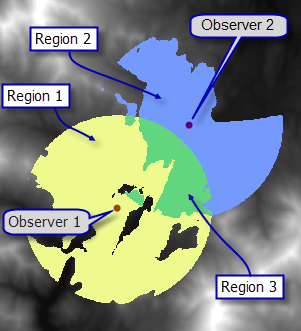
I am working with ArcGIS 10.1, I determined the viewshed and the fuzzy viewshed for 10 points placed along a river, my willing is to create a statistics (table or graph), using the results, in which it is possibile to see the percentage of overlapping between the visible area (according each point) and the percentage of visibility for each point according the landscape in all cardinal points. Is it possible? Any suggestions?
Thank you