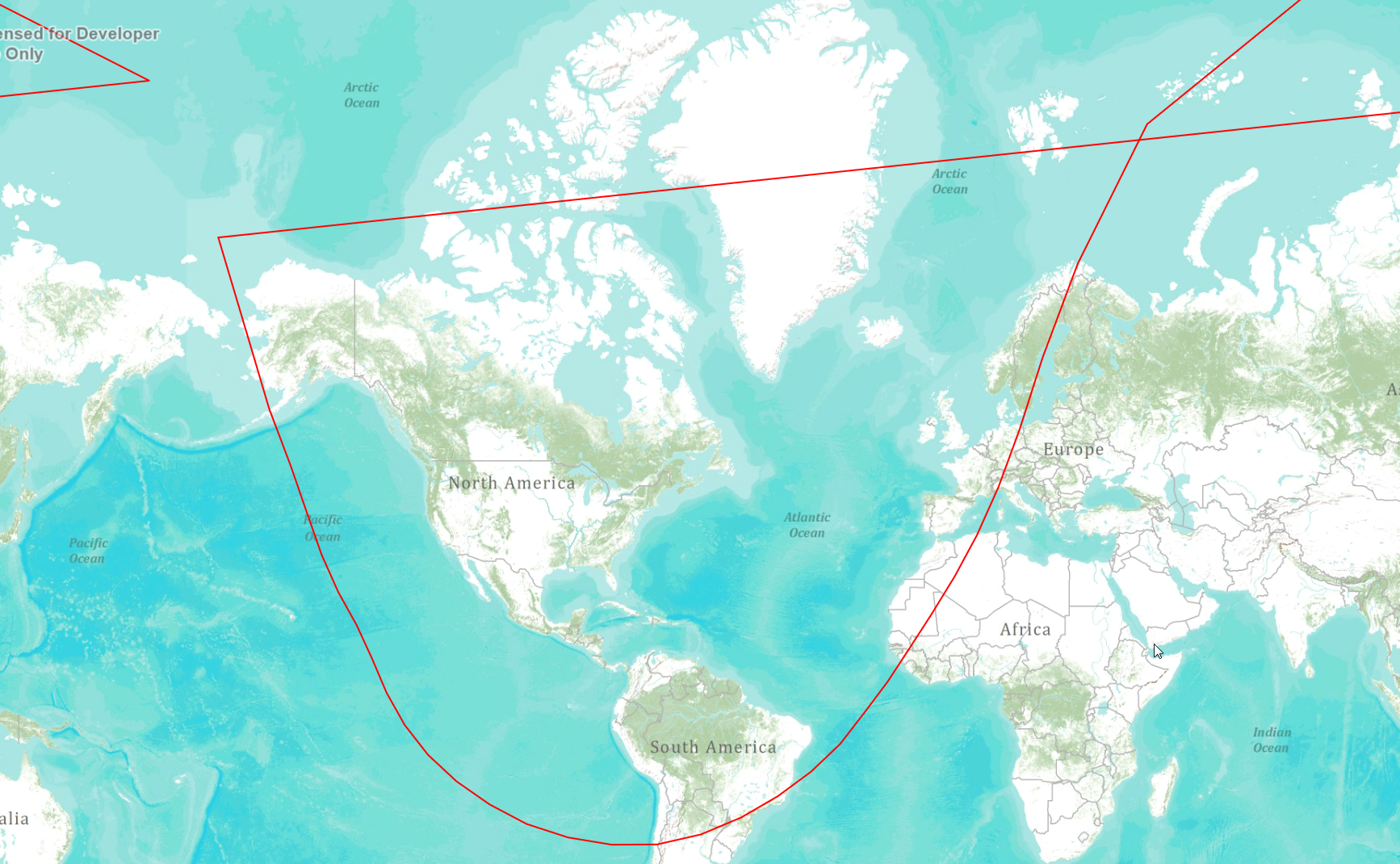
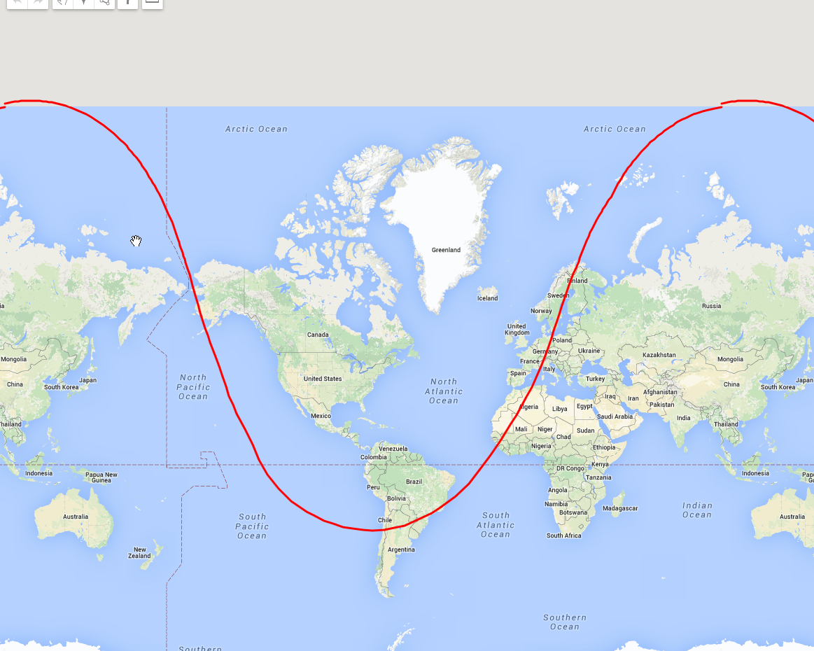
I'm trying to create a range map based on coordinates. Whether I do it with code or by KML file in ArcGIS, my results are way different than importing the same exact KMLfile in Google Maps. Any advise on correcting this to look more like Google Maps? Keep in mind this application is ran completely offline, which is why I cannot use Google Maps
Here is the KML File:
<?xml version="1.0"
encoding="UTF-8"?>
<kml
xmlns="http://www.opengis.net/kml/2.2">
<Document><name>My document</name>
<description>Content</description>
<Style id="Lump">
<LineStyle><color>CD0000FF</color><width>2</width></LineStyle>
<PolyStyle><color>9AFF0000</color></PolyStyle>
</Style>
<Style id="Path">
<LineStyle><color>FF0000FF</color><width>3</width></LineStyle>
</Style>
<Style id="markerstyle">
<IconStyle><Icon><href>
</href></Icon></IconStyle>
</Style>
<Placemark><name>NAME</name>
<description>YES</description>
<styleUrl>#Path</styleUrl>
<LineString>
<tessellate>1</tessellate>
<altitudeMode>clampToGround</altitudeMode>
<coordinates>
98.63,85.02
43.08,79.07
26.97,70.88
18.8,62.3
13.47,53.5
8.57,44.8
3.58,36.35
-1.63,28.2
-6.93,20.33
-12.12,12.63
-17.17,5.02
-22.63,-2.25
-28.22,-9.43
-34.98,-15.7
-42.67,-21.08
-51.18,-25.62
-60.55,-29.12
-70.7,-31.12
-81.2,-31.18
-91.42,-29.72
-101.02,-26.97
-109.62,-22.85
-117.3,-17.83
-123.9,-11.9
-129.32,-5.05
-133.55,2.47
-136.9,10.3
-140.45,17.78
-144.75,24.98
-148.6,32.53
-152.02,40.37
-155.85,48.28
-160.8,56.27
-165.75,64.48
-172.62,72.78
171.35,80.83
98.93,85.17
</coordinates>
</LineString>
</Placemark>
</Document>
</kml>
Google Map View:
ArcGIS View: