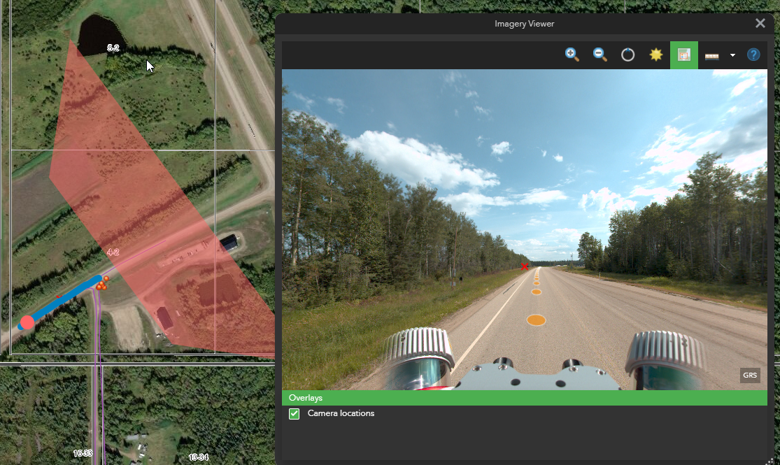
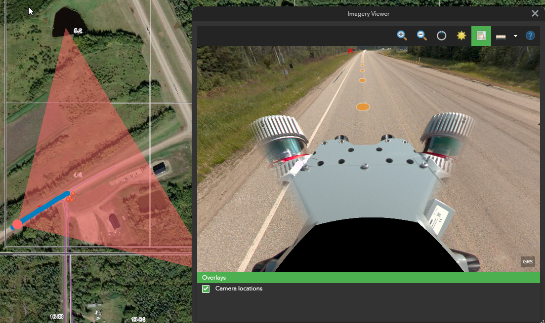
Hi - I'm using the WAB Oriented Imagery Tools and when looking at the coverage graphic in the map, when my 360 is approx level (0 pitch) the coverage area appears to be incorrect, clipped further then an the image centre than it should be.
If I tilt the 360 viewer down by approx 40° then the coverage polygon appears as I believe it should in the first instance.
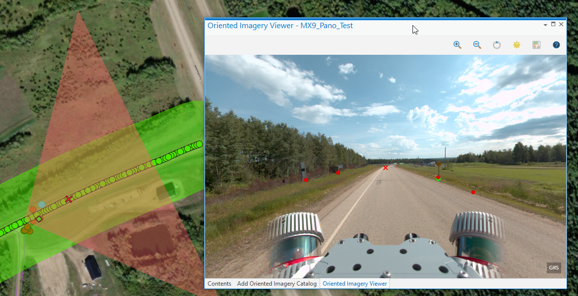
When viewed in the Pro the coverage area is correct when there view is level no pitch (lowest screen capture).
I have accurate pitch values, approx 90° for all images.
I'm wondering is the elevation service in AGOl affecting the camera height in anyway ? or is the WAB OIC widget calcing the coverage incorrectly? or something else?