I've been working on a simple map with ArcGIS Online: I imported a point-shapefile of several European cities and added the basemap "Terrain with labels". The basemap is perfect but it shows country borders, rivers, lakes and labels above my points. This doesn't only look strange, it also makes the map hard to read as e.g. the point in Baku is overlapped by the Caspian Sea. Is there any way I can change the display to make the points top layer again?
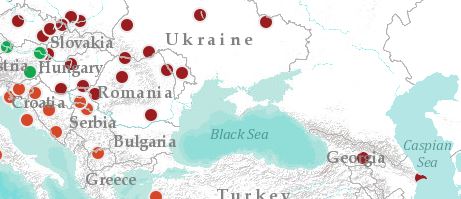
Thank you for your help!


