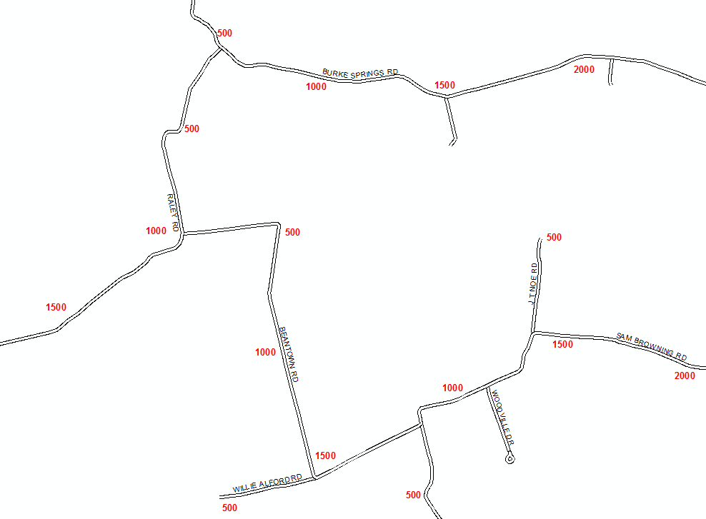
I would like to place labels along roads showing the range of the addresses. I don't want to label the range values at intersections but to use a preset value. Such as 500, 1000, 1500, etc. So if you were following "Smith Rd" along on the map you could see the range you were in. I need to do this for multiple jurisdictions thus several map books for which an automated process would be most valuable.
Since many addresses are milepoint based I had considered using various tools to create points along a line this but it doesn't work in part because many ranges don't start at zero and it won't handle block style address ranges.
Other option I considered is to use a table with the address ranges of each road and create fake addresses for each value I want. Eg. 500 Smith Rd, 1000 Smith Rd, 1500 Smith Rd etc. until the ranges available are exhausted. This table could then be geocoded and would create the point shp file I could use to label with. As you could imagine this is a very time consuming process doing a lot of sorting and cutting and pasting in Excel for each jurisdiction set I want to create.
A method to create points of pre-selected values along a line based on standard address range coding (Left From, Left To, Right From, Right To) would be most helpful.
Any guidance is very appreciated.
Thanks
Mike
Example Cartographic Result Desired.