Hello Everyone,
I'm trying to use spatial-based weather data (temperature, rainfall, wind, etc) to estimate and create a weather surface across Brisbane, Australia. I only have data of 13 locations in total as shown in the attached figure across Queensland, the state for which Brisbane is the capital city. It seems that kriging is a possible and proper solution to fulfill my goal. However, some suggested that at least 30 distinct locations of data were ideal to do kriging. I currently don't have other datasets and doubt there will be. So my question is how can I apply the kriging method to this rather sparse weather data to generate a reasonably acceptable results of weather surface? Do I add artificial points such as copying the same data point to nearby locations?
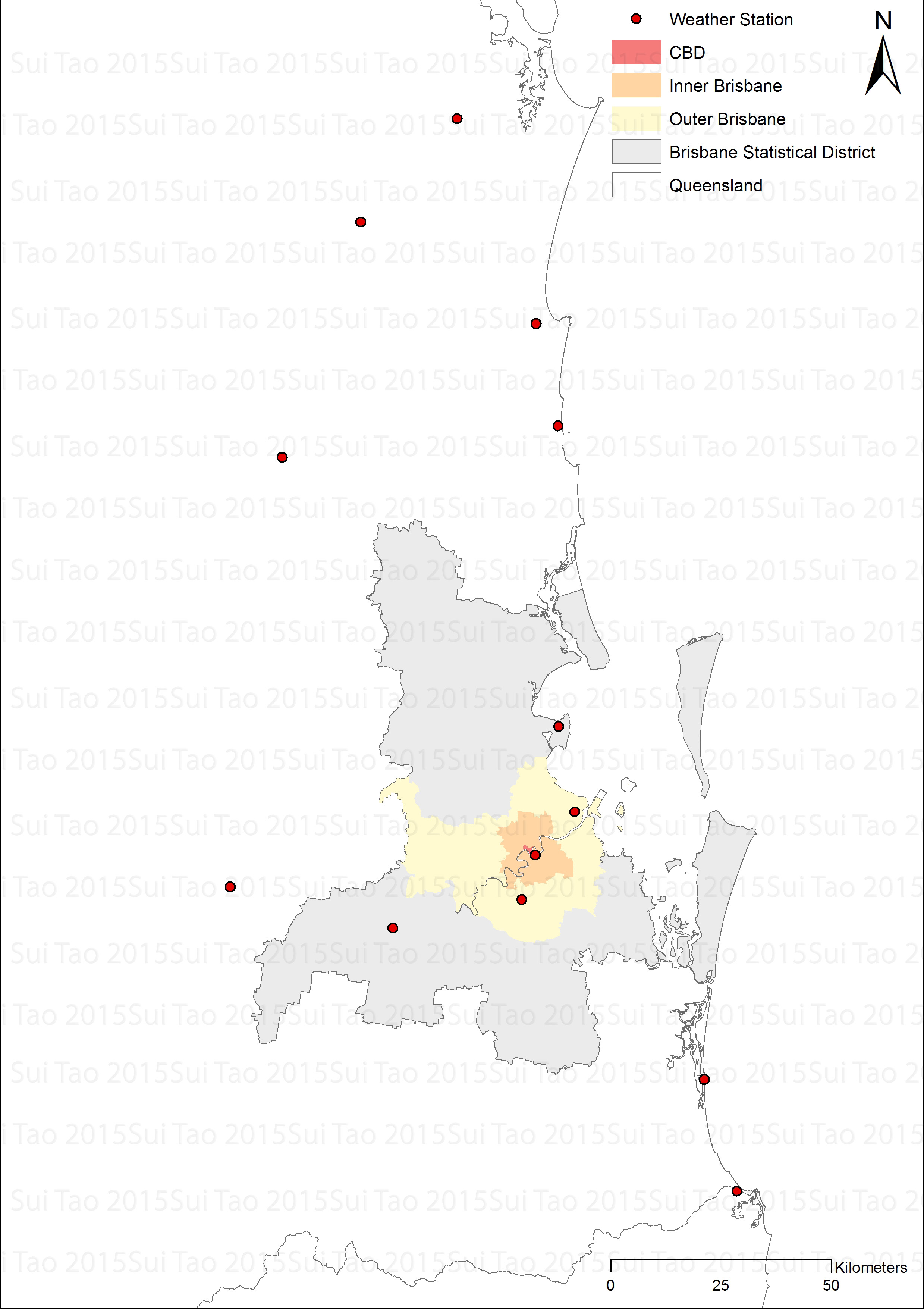
Any suggestions are welcome. And thank you in advance!
Best regards,
Sui Tao



