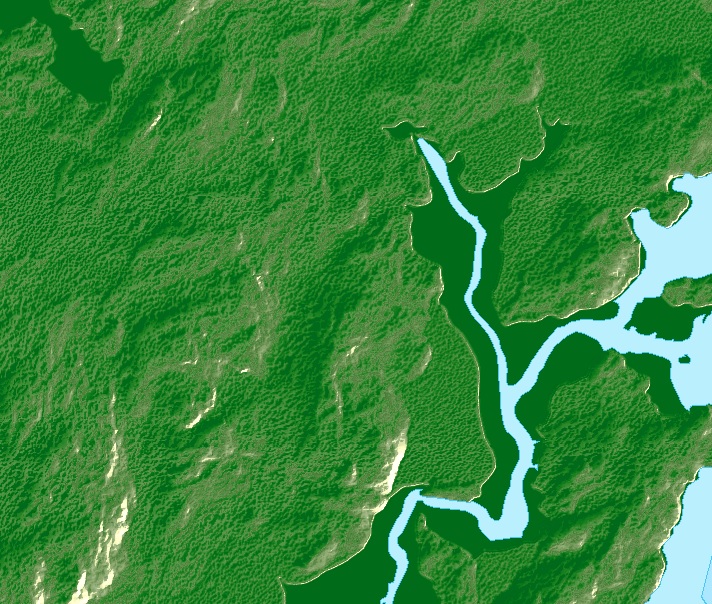
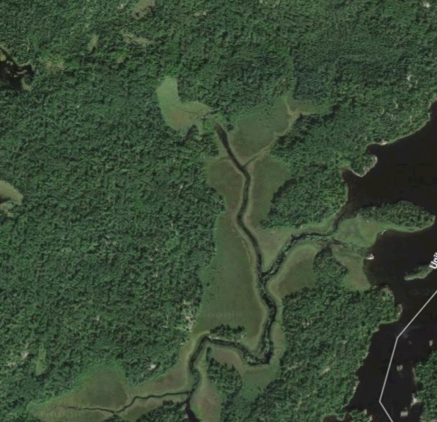
I am using ArcGIS for desktop, latest version. I used Spatial Analyst Hillshade tool and checked the box for Model Shadows to create a topo relief map. I don't like the look I get but I have tried every way to change the properties of the layer in ArcMap. Maybe the look I am able to get is limited by DEM data I am using? If I can somehow make this "relief" look better, that would be great but either way, I need to find a way to fix the low land areas. In the image below, the low areas are dark solid green. I the second image, below, from Google Maps, you can see that the low land areas are swamp/marsh. How can I change the color of this low land from from solid, dark green to something to indicate swamp? Is it a matter of doing something with the properties in AcrMap? Or, do I need to extract this solid, dark green data from the DEM data so that I can have it as a separate layer which I can represent with a swamp/marsh symbol? If that is the case, how do I separate the DEM data? Thanks, for any help you can offer. Let me know if you need any more information.