I'm trying to use the Profiling Tool on the Water Utility Reporting Toolbar (although mine is called the Infrastructure Reporting Toolbar) for a section of my stormwater utility network. Since I am not currently using ESRI's Local Government Model I have configured the tool to work with my network.
The tool runs successfully - albeit with a few problems - on a section of pipe where I have no elevations included in my attribute data. I get a profile like this:
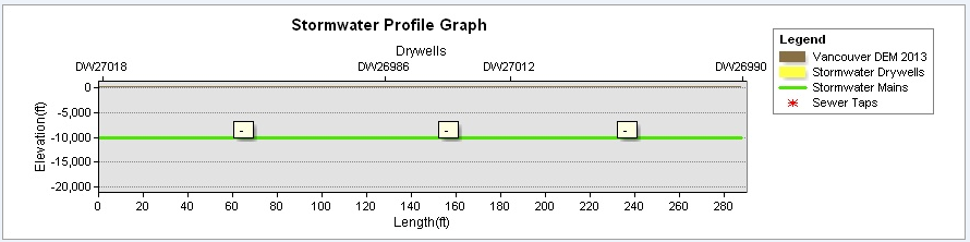
The main is shown at -10,000 ft. (obviously a problem) and my drywells are not visible, but at least the tool generates a result.
After I add elevation attribute data to my network (drywell rim and bottom elevations, main upstream/downstream inverts) the tool gives me the following error: Error in the ProfileGetRelatedSewerElevData Specified cast is not valid.
Can anyone help me determine what I'm doing wrong with my configuration? What is the "specified cast"? I need to show accurate elevations in my y-axis and I need my drywells to be visible. I have attached my configuration file if that helps. I am using ArcGIS 10.2.2.3552 for Desktop with an Advanced license.
Many thanks in advance!



