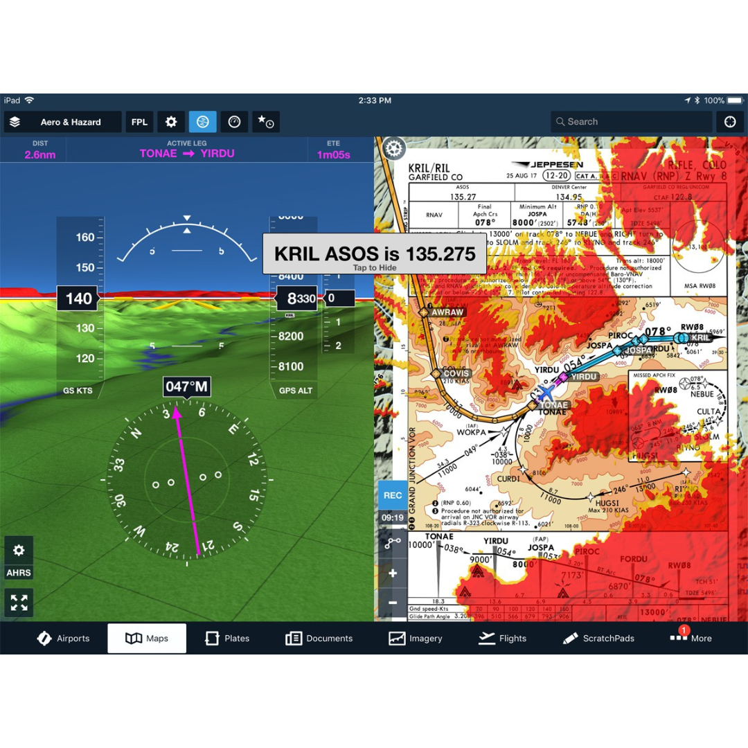
I want to be able to color the map according to elevation relative to an altitude. I am having trouble finding an example. Hopefully someone here can point me in the right direction. The attached image shows some colorization levels relative to the altitude of an aircraft on approach, red is at or above current aircraft levels and the other colors at lower and lower thresholds.
How can I use the terrain data to achieve similar colorization using the ArcGIS Qt C++ SDK? I need to do it on a 2D as well as a 3D map.
Any and all help is much appreciated!
Thanks!