Good morning. I have a working app, but I have running into an issue with the graphics. I have the app set up, where the user can make a number of picks (draw points) on the map until they are ready to submit (applyEdits) to the feature layer. Right now, I use the standard map graphics layer and clear the graphic each time the user makes a click on the map. I do not want to display the graphic each time the user makes a pick, only have it display as they make an individual pick.
Now for the tricky part. After the user makes their final pick and decides to submit, I want the graphics to remain on the map until the application closes. To do this, I have set up a Graphics layer, The problem is, when I pass in the geometry (feature), the graphic displays as I want, but only if the Feature Layer is set to Visible: True. I need the Feature Layer to remain Visible: False, since the data will be sensitive to the Public. When the Feature Layer is set to Visible: False, The graphics layers becomes hidden as well.
So in short, how can I have the feature layer where the visibility is set to false, yet have the Graphics layer display?
Below are samples of my work flow and some code:
1. Drawing the Point and submitting after 3 picks (the third pick is the point I want to submit)
Buttons used to perform draw and submit

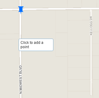
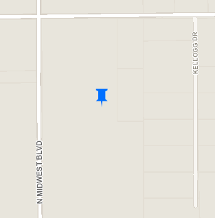
Performing a Draw using the Draw Hot Spot 1. On the third pick, I want to submit. The graphic is cleared as I want. Notice how the graphic disappears each time it is re-drawn. I want this to occur by design.
Pick 1
Pick 2
Pick 3
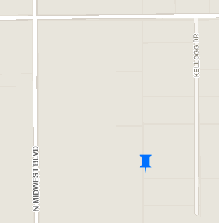
When hitting the Submit Hot Spot Button, it posts to the feature layer with an alert.
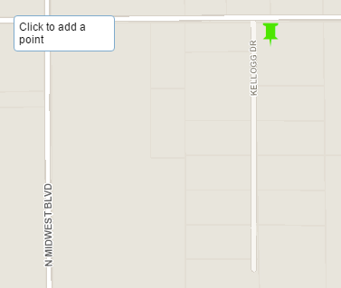
Now when going to Draw Hot Spot 2, notice how a new graphic is drawn, but the blue pushpin disappears. This is what I do not want.
Now for the code:
Graphics Layer:
// Symbols - Picture Marker Symbols
symbol1 = new PictureMarkerSymbol('http://gis.edmondok.com/tfstudy/graphics/pushpin_blue.png', 30, 30);
symbol2 = new PictureMarkerSymbol('http://gis.edmondok.com/tfstudy/graphics/pushpin_green.png', 30, 30);
symbol3 = new PictureMarkerSymbol('http://gis.edmondok.com/tfstudy/graphics/pushpin_red.png', 30, 30);
// Graphics Layers with Picture Symbols
var symbol1GraphicsLayer = new GraphicsLayer();
var symbol2GraphicsLayer = new GraphicsLayer();
var symbol3GraphicsLayer = new GraphicsLayer();
Feature Layer:
// Feature Layers
// 01. Traffic Intersections 1
//var trafficInt1 = new FeatureLayer("http://services6.arcgis.com/rCwK7cyJnCFF9MvM/arcgis/rest/services/TrafficIntersections/FeatureServer/0", {
var trafficInt1 = new FeatureLayer("https://sampleserver6.arcgisonline.com/arcgis/rest/services/Military/FeatureServer/6", {
mode: FeatureLayer.MODE_SNAPSHOT,
visible: false,
outFields: ["*"]
});
Draw and Editing
// Create Draw and Edit Toolbars 1
function createToolbar1() {
drawToolbar1 = new Draw(map);
editToolbar1 = new Edit(map);
drawToolbar1.on("draw-complete", addGraphicToMap1);
}
function addGraphicToMap1(evt) {
map.graphics.clear();
newAttributes1 = {"direction": "1"};
newFeature1 = new Graphic(evt.geometry, null, newAttributes1);
value1 = map.graphics.add(new Graphic(evt.geometry, symbol1, newAttributes1));
console.log("Graphic geometry for Hot Spot 1 is: ", value1);
}
function addGraphicToTrafficInt1(evt) {
value4 = trafficInt1.applyEdits([newFeature1], null, null);
console.log("Graphic Applied to Feature Layer (0)", value4)
// Graphics Layer and Adding Geometry
newFeature1.setSymbol(symbol1);
symbol1GraphicsLayer.add(newFeature1);
map.addLayer(symbol1GraphicsLayer);
alert("You have successfully added Hot Spot 1")
drawToolbar1.deactivate();
editToolbar1.deactivate();
registry.byId("Point1").on("click", function editDisconnect1(){
drawToolbar1.deactivate();
editToolbar1.deactivate();
alert("Hot Spot 1 has already been added.")
});
dojo.disconnect(handle4);
};
Anyone have any ideas? As always, thanks for the feedback.


