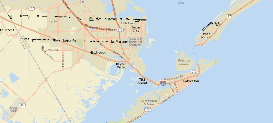
I'm pretty new to this, and I've been trying to follow the guides here. We have a simple service serving out a feature layer for parcels. When I load it up in in the ArcGIS.com map (the layer takes a minute to load), it displays fine. When I try to place it on a map in my own webpage, only a small number of the parcels display. Any help would be greatly appreciated. Below is my code:
<html>
<head>
 <meta charset=utf-8 />
 <title>Galveston GIS Testing</title>
 <meta name='viewport' content='initial-scale=1,maximum-scale=1,user-scalable=no' />
 <link rel="stylesheet" href="https://js.arcgis.com/4.1/esri/css/main.css">
 <script src="https://js.arcgis.com/4.1/"></script>
 <script>

var parcelLayer;
 require([
 "esri/Map",
 "esri/views/MapView",
 "esri/layers/FeatureLayer",
 "dojo/dom",
 "dojo/on",
 "dojo/domReady!"
 ], function(Map, MapView, FeatureLayer, dom, on) {

parcelLayer = new FeatureLayer({
 url: "http://gis.cityofgalveston.org/arcgis/rest/services/KML_test/TEST_api/MapServer/0",
 id: "parcels",
 visible: true
 });

var map = new Map({
 basemap: "streets",
 layers: [parcelLayer]
 });

var view = new MapView({
 container: "viewDiv", // Reference to the DOM node that will contain the view
 map: map,
 center: [29.25, -94.84] // References the map object created in step 3
 });

parcelLayer.then(function() {
 view.goTo(parcelLayer.fullExtent);
 });
 });
</script>
<style>
 html, body, #viewDiv {
 padding: 0;
 margin: 0;
 height: 100%;
 width: 100%;
 }
</style>
</head>
<body>
 <div id="viewDiv"></div>


</body>
</html>

Here's a screenshot of the map I get: